Take a Second Look

In pursuit of second impressions

  • Stories
    • Archived Stories I
    • Archived Stories II
    • Archived Stories III
    • Archived Stories IV
    • Archived Stories V
    • Archived Stories VI
  • Photo Galleries
    • Gallery Archive - Africa I
    • Gallery Archive - Africa II
    • Gallery Archive - Africa III
    • Gallery Archive - Antarctica I
    • Gallery Archive - Europe I
    • Gallery Archive - Europe II
    • Gallery Archive - Europe III
    • Gallery Archive - North America I
    • Gallery Archive - North America II
    • Gallery Archive - Central & South America I
    • Gallery Archive - Central & South America II
    • Gallery Archive - Central & South America III
    • Gallery Archive - Oceania I
    • Gallery Archive - Oceania II
    • Gallery Archive - Oceania III
    • Gallery Archive - Asia I
    • Gallery Archive - Miscellaneous
    • Gallery Archive - Game Reserves I
    • Gallery Archive - Game Reserves II
    • Gallery Archive - Game Reserves III
  • About
  • Contact
The weather at Magdalenefjord (north of Ny-Ǻlesund  is changeable: one moment the sun shines, snow falls the next. The landscape is deserted and surreal. Beautiful!

The weather at Magdalenefjord (north of Ny-Ǻlesund  is changeable: one moment the sun shines, snow falls the next. The landscape is deserted and surreal. Beautiful!

Ny-Ǻlesund, Spitsbergen, Norway

November 16, 2017 by Rhyan Thomas

Ny-Ǻlesund is the northernmost (year-round) human settlement in the world. Located on the island of Spitsbergen, ten degrees further north than the north coast of Alaska and at the same latitude as Canada’s Ellesmere Island and the northern tip of Greenland, Ny-Ǻlesund has a remarkable history steeped in heroism, exploitation of the natural environment and scientific research.

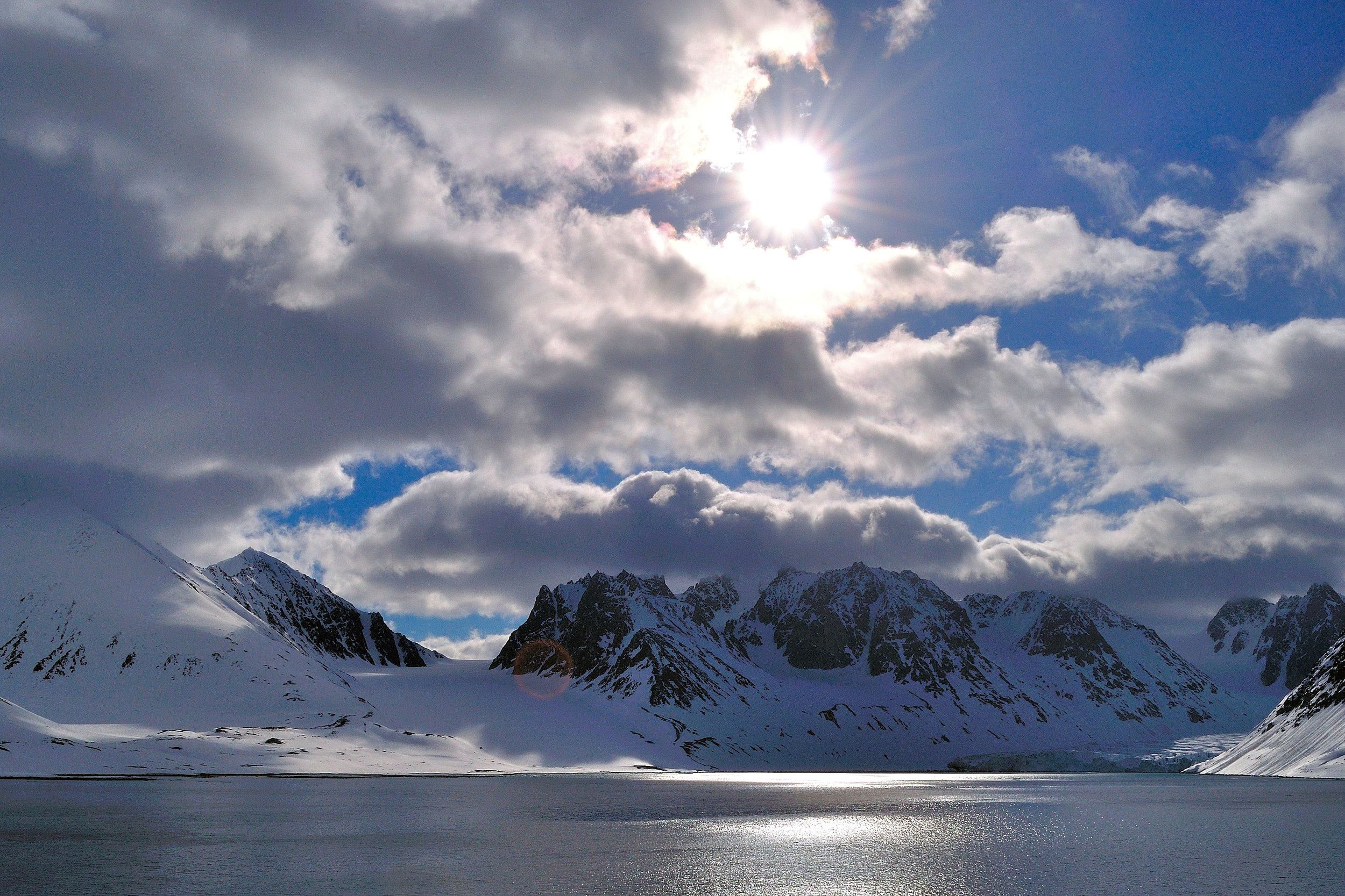
Spitsbergen is a part of the Norwegian archipelago of Svalbard which is about 1 ½ times the size of Switzerland. Spitsbergen is Norway’s largest and the world’s 36th largest island. It was named by the Dutch sailor Barentsz, who found the archipelago when he was looking for a northern sea route to China in 1596. He thought the mountains looked very pointy (spitz = pointed, bergen = mountains), thus the name.

Spitsbergen must have teemed with life at the time of the archipelago’s discovery. Whales, polar bears, walruses and seals feasted in the waters near the glaciers while arctic terns, kittiwakes, guillemots and puffins flew overhead and reindeer scraped snow away from the rocks to get to the lichen below. The scene must have been spectacular. In the 400+ years since then, humans have come, wiped out the whales, decimated the walruses and seals, dug out the mountains, drilled the sea and desecrated the glaciers. Luckily, life this far north is tough and the humans never stayed for long. Even now, in 2014, less than 3,000 people live on Svalbard, spread out over 4 communities: Longyearbyen, the administrative center of the archipelago and the only place with a transportation link to the outside world, Barentsburg, a Russian mining community, Sveagruva, another mining outpost and Ny-Ǻlesund which is primarily a research settlement. Despite the human interference, Svalbard still is an extraordinary arctic landscape, a vast frozen wilderness that can awe the senses and make you feel insignificant in the face of such natural grandeur and beauty.

“How on earth can people live here?” is probably every civilized person’s first response to seeing Ny-Ǻlesund. Well, first of all it’s because of the Gulf Stream, that warm ocean current coming up from Mexico. This maritime influence creates a much milder climate than one would expect at this northern latitude and only 1,200 km (750 miles) south of the North Pole. Winter temperatures here are only minus 12 C to minus 16 C, while the summers can be a balmy 4 to 6 C.

Secondly, human curiosity drove people to come here to investigate ocean currents and weather. Ny-Ǻlesund was established as a scientific base in 1868 by the German explorer Carl Koldewey, who wanted to know what the heck was going on. During the time of arctic exploration in the 19th century, expedition teams heading for the Pole reported drifting south on ice shelves faster than they were travelling north. Hmm, I can understand why they would be frustrating!

Thirdly, there was (is) coal in them hills! For a brief period starting 1916, people mined for coal here until the human cost in the form of repeated fatal accidents in the mines, became too great. A German-built locomotive with rail cars at Ny-Ǻlesund’s pier are silent reminders of this area’s mining history (see picture).

Fourthly, Ny-Ǻlesund served as a launching point for polar expeditions. It is from here that Roald Amundsen, one of Norway’s greatest heroes, his flying partner, the Italian engineer Umberto Nobile and Oscar Wisting, Amundsen’s partner in the successful South Pole expedition, launched the airship “Norge”. They, together with 13 other men, left Ny-Ǻlesund on May 11, 1926, flew over the North Pole and landed in Alaska 3 days later. This makes Amundsen and Wisting the first men to reach each geographical pole by ground and by air. The mooring tower for the airship still exists just outside of Ny-Ǻlesund (see picture). Amundsen also tried to reach the pole by plane from here. He made it to 87 degrees NL before he had to turn around.

These days, Ny-Ǻlesund is an international scientific community consisting of 11 research stations operated by 10 different countries (Norway, Germany, Japan, Great Britain, the Netherlands, Italy, France, South Korea, China and India). Four of the 11 stations are operated year-round. In addition, institutes from other countries send their scientists to Ny-Ǻlesund for the summer months. What kind of are they doing up there? First and foremost atmospheric studies. Because of its clean air, Ny-Ǻlesund is the perfect location for monitoring the atmosphere. While major cities around the world record 10 to 30 million particles per cubic centimeter, the air up here only contains 300. Other research conducted here includes studying of climate change, marine life, mammals, water temperatures, barnacle geese and other local wildlife.

When all the souls in town are counted (polar bears excluded), you’ll find 30 Ny-Ǻlesund inhabitants in winter and 150 in summer. I wonder how they all get along during the World Cup. At least, to keep the peace in the village, the Ny-Ǻlesunders have the option of setting the obstinate party adrift on an ice float in the Arctic Ocean. They wouldn’t even have to worry about the exiled party’s safety. After all, the ice float would be drifting south.

November 16, 2017 /Rhyan Thomas
Comment

Manta, Ecuador

November 16, 2017 by Rhyan Thomas

The town of Manta is the “Tuna Capital of the World”. When I hear the word “tuna”, I immediately think of over-fishing, depletion of the oceans and critical stocks. As it turns out, the tuna caught off the coast of Ecuador belong to three species: the yellowfin, the bigeye and the skipjack tuna. Bluefin tuna stocks (Bluefin are native to the Atlantic and Mediterranean seas), have seen their population drop 80% since 1999.   Their populations are considered “critical”, primarily because of the “Spanish Fishing Armada” which, according to Greenpeace, sails the world’s ocean in pursuit of more substantial tuna catches. The International Seafood Sustainability Foundation (ISSF) has categorized the stocks for yellowfin and bigeye as “yellow”, meaning the stocks cannot support an increase in fishing. Only the skipjack tuna are rated “green”, indicating healthy populations.

We don’t eat tuna in our house, but I am drawing up my own action plan in response to my research: I will eliminate tuna from our cats’ diet. 

Surely, the cats will understand.

November 16, 2017 /Rhyan Thomas
Comment
Downtown Dubai as seen from the viewing platform of the Burj Khalifa.

Downtown Dubai as seen from the viewing platform of the Burj Khalifa.

Dubai, United Arab Emirates

November 15, 2017 by Rhyan Thomas

You could (as Alain Robert did in 2011) climb up the outside of the building, all 828 m (2,717 ft) to be exact. That would take you about 6 hours (if you were crazy). Or you could take the stairs to the 160th floor, all 2,909 steps to be exact. That would take you about 1.5 hours (if you were fit). Personally, I prefer to take one of the fastest elevators in the world to the top. That takes me about 1.5 minutes. You see, the tallest building in the world is a building of extremes, it defies description. It is a building of superlatives, a building that celebrates human achievement at the same time as it pushes the envelope of what is possible. It is also a monument to opulence and materialism.

At an estimated cost of 1.5 billion, the Burj Khalifa in Dubai (Burj =  tower; Khalifa = name of United Arab Emirates’ president) has broken 17 world records during its construction from 2004 to 2011. As the centerpiece of Dubai’s new city core, it represents the ambition of a city and country that is trying to wean itself off a declining oil based industry (7 % of Dubai’s economy) by pushing tourism, financial and technological services, aviation industries and real estate.

There is no doubt: the Burj Khalifa is an impressive structure, and not just the dimensions and specs are extraordinary. The finish and the quality of the workmanship are spectacular, too. No expense has been spared. But, as with so many things in Dubai, one has to ask: “why?” Why does everything in Dubai have to exude wealth, success and prosperity? Why does Dubai have the largest shopping center in the world? Why build a snow park to go skiing in the middle of the desert? Why create artificial islands in the ocean when Dubai has such a beautiful coastline? Why does the police in Dubai drive Ferrari and Lamborghini? When I asked those questions to our driver, he responded: “It is not because we need these things or because our police have to give chase to speeding drivers. It is because we want to show the world how rich we are.”

But the dream has stalled during the past few years and much of what the tourists see is facade. With a foreign debt of US$80 billion, Dubai, as a city, is broke. Driving through the outskirts of Dubai I pass building project after building project – half finished and deserted. The economic slowdown from 2008 to now has made investors nervous and left its mark on the city. The idea that lightning speed progress and growth can go on forever has definitely been dampened. Now that property values have dropped sharply (some by over 60 %), the city has to catch up to itself. The surplus residential and commercial real estate has to be occupied first before new giant construction projects (like the Burj Khalifa) can be instigated or the half - finished projects can be completed. But as one of seven emirates in the United Arab Emirates (UAE), Dubai enjoys the financial backing of its oil-rich neighbours. So, US$ 80 billion of debt are peanuts when your country’s oil and gas exports represent 85 % of the economy.

The overall wealth of the country is staggering, which makes one contentious issue even more puzzling: the poor treatment of migrant workers. At the peak of the construction boom in Dubai 95% of the city’s workforce consisted of migrant workers from other countries, mostly India, Pakistan, Sri Lanka and Bangladesh. When asked about the city’s population, our driver pauses. “I can’t give you a definite number” he said, “people from other countries come and go. The number fluctuates. We estimate it to be around 2,000,000 for Dubai.”

Many claim that the success of Dubai has been built on the backs of the poor and impoverished. The accusation of modern slavery has stained Dubai’s image as a playground for the hip, rich and famous. The construction of the Burj Khalifa became a focal point when the BBC, NPR and Human Rights Watch drew the world’s attention to the misery of migrant workers. Their findings were disturbing and their criticism was scathing. It left a country that wants to be seen as sophisticated and modern, scrambling to find excuses for its negligent treatment of workers and blatant disregard for some of the most basic human rights.

~ RT 

November 15, 2017 /Rhyan Thomas
Comment
The skyline of Dubai. The tallest building is the Burj Khalifa.

The skyline of Dubai. The tallest building is the Burj Khalifa.

Dubai, United Arab Emirates

November 14, 2017 by Rhyan Thomas

Meet Sudahkar, a 24-year old construction worker. To escape poverty in his native Sri Lanka and to help support his family of younger siblings and elderly parents, Sudahkar is willing to take a risk. When he hears about the building boom in Dubai, Sudahkar sees an opportunity to earn money. He takes out a loan for US$ 2,500 and pays the money to a local recruitment agency. In return, the office will provide him with a well-paying employment contract, housing, transportation to Dubai, a passport and a working visa. Sudahkar signs the contract even though he is illiterate and doesn’t know what the contract says. The $2,500 are a huge risk for him but Sudahkar has been re-assured, that he will be able to start re-paying his loan almost immediately. Upon arrival in Dubai, his passport is confiscated and he is driven to the gated and guarded workers’ camp 1 hour outside town. The camp is abysmal: 7,500 labourers are cramped into 1,248 rooms with poor ventilation. The toilets are overflowing. He has to share his room with 7 other workers. The ground outside his room is flooded with sewage, so he and his colleagues are finding large stones to walk on. At work, Sudahkar soon learns the grim reality of his situation. He will work 12 hours per day, 6 days per week. He will not receive a paycheque during the first two months of his employment, putting him in arrears with his lender at home already. He will earn $175 per month, far less than promised (avg. salary in Dubai US$ 2,106/mth). He will be indentured to his employer for two years and will not be allowed to leave Dubai. He will have to work under very dangerous conditions and is not allowed to complain. He will not be allowed to strike and engage in collective bargaining with his fellow workers as it is against UAE law. One day, at the end of his work shift, the buses that transport the labourers back to their accommodations, are late. In frustration, he and his fellow workers lose their temper. They destroy cars, smash windows, wreck construction equipment and battle with police. When the dust settles, US$ 800,000 of damage has been done and the workers are threatened with deportation, an option that is no option to men who are over their heads in debt. That evening he calls home. He knows he has to pretend that everything is fine. He does not want his family to worry. But things are far from fine.

The above is the fate of thousands of construction workers in the UAE. While laws are in place to protect workers from unfair treatment and exploitation, violations of those laws are the norm and go unpunished. Human Rights Watch was unable to find evidence of even one delinquent employer receiving a prison sentence or a fine.

As I sort my photos on my computer and look at the Burj Khalifa again and again, I am amazed how the tower, the opulence of the furnishings, the view of Dubai from above and the quality of workmanship inside the building are beyond anything I have ever seen. It is as if I had walked into a fairy tale. UAE officials claim that only 1 worker lost his life during the construction of the tower. However, everyone agrees that lies, payoffs and cover ups will succeed in keeping the truth from being reported. We will never know how many families in India, Pakistan, Sri Lanka and Bangladesh mourn the loss of a son, a father or a husband.

~ RT 

November 14, 2017 /Rhyan Thomas
Comment
Camels at a ranch for racing camels south of Dubai.

Camels at a ranch for racing camels south of Dubai.

Dubai, United Arab Emirates

November 14, 2017 by Rhyan Thomas

Driving along a six-lane highway heading south from Dubai city, I notice signs along the road for Camel Race Tracks. Curious, I ask our driver about camel racing. “This is a very popular sport in the UAE (United Arab Emirates)” he explains. “Camel racing is big in all of the Arab Gulf States, but nowhere is it as huge as in Dubai. We have 15 racetracks in the UAE alone. You can’t bet on ‘your’ camel, but prize money for the winners is considerable.” “And who rides these camels?” I ask. “The camels are ridden by robots” our driver answers. Ridden by what? I ask again. “The camels are ridden by robotic jockeys” he confirms. So, I DID hear correctly. The camels’ owners put robots on their camels instead of riders. “Don’t believe me?” he asks. “Check it out on YouTube.”

And so I did. Back on the ship I Google “camel” “racing” “robot” “jockeys”, but rather than learning about this curious little machine that sits on a camel’s back and drives the animal forward, I discover more than my stomach can handle about the dark side of the Sheikh’s favourite sport: child slavery. But let me explain:

Camel racing in the Arab world is an old tradition, but in modern times the sport has become ultra competitive. Racing camels cost millions of dollars. They are fed a high-nutrition diet of milk, dates, honey, barley and clover spiked with vitamins. At its fastest, a camel can run 65 km/h (40 mi/h), but not for long. The most competitive camels are females, many of which can race 40 km/h (25 mi/h) for up to an hour. Riding these camels is difficult as there isn’t much to hold on to. The weight of the jockey is especially crucial if you want to be competitive – the less the better. And that’s why starved children are being used. They are perched on the backs of the camels, beat the animals with a whip and drive them forward by yelling and screaming loudly.

The “recruitment” of child jockeys has a particularly ugly side. Kidnapped, taken, smuggled or bought from desperate parents who cannot feed their families, children as young as 3 years of age are brought to the UAE from South Asian countries (Pakistan, India, Bangladesh). In the UAE, they live behind barbed wire at camel farms and camel race tracks. The police and immigration officials are complicit in this. They turn a blind eye knowing very well that the kings and sheikhs like to keep the sport as it is. Beaten, sexually abused and starved, these little children live dangerous lives. Many fall off the camels during practice runs and races, get trampled by the animals and severely injured or even killed. When a child dies, it is buried in an unmarked grave. Because of the dangers involved, Arab children are no longer used.

In 2002, the UAE officially banned the use of child jockeys. In 2005 the government raised the minimum age for camel jockeys to eighteen years of age, it introduced prison penalties and fines for violators, reached an agreement with UNICEF over the repatriation of the children and offered compensation to the families. Some were rescued and returned to their home countries and families while some were placed in a shelter for child camel jockey victims. Repatriation, however, is difficult. Many children were so young when they were taken from their families, they don’t know their home country, don’t speak their native language and don’t recognize their parents. Also, unless the parents’ situation has improved, mom and dad are likely to resell their child. If the children’s parents are found and the children are allowed to stay with their families, they face enormous challenges. Stunted in their development mentally and physically by malnutrition, physical abuse and mental stress, they are damaged for life.

During my brief research into this sad subject, I am curious to see if the practice of child smuggling and slavery for the purpose of camel racing is still a problem. The most recent article I can find was published by The Express Tribune, an English language Pakistani newspaper on May 8, 2013. The article’s author, Zahid Gishkori writes about the struggle families face when their children are returned from the UAE (as their children are now mentally unfit to live on their own). He also writes: “A decade after being banned, those working on the camel jockey supply chain ... in Pakistan have yet to close up shop” and “There is always a buyer if there is a seller.” He closes his article with this: “The Express Tribune had written to the UAE mission in Pakistan for their version on this issue but it refused to comment.”

Sadly, the UAE is not the only country that continues to use child jockeys during camel races. Other Gulf States are equally guilty of child slavery. Yes, robots have replaced jockeys on the most high profile race tracks in the region but many tracks, primarily those hidden from the eyes of tourists, still adhere to the practice of importing and enslaving children from the poorest countries on earth.

~ RT 

November 14, 2017 /Rhyan Thomas
Comment
Torres del Paine National Park, Patagonia, Chile

Torres del Paine National Park, Patagonia, Chile

Punto Arenas, Patagonia, Chile

November 14, 2017 by Rhyan Thomas

Just before taking off on our little plane for the afternoon return trip to Punto Arenas, the co-pilot turned around and made this announcement: “Same instructions as this morning.” This kind of informality comes with the territory. Patagonia is very much frontier country.

Magellan called this land Patagonia because of the size of its people: Patagonia – the Land of Giants. When the Europeans arrived here and met the natives, they hardly came up to their waistline! The natives are gone now. Along with Jesus, the Europeans introduced war and diseases to the local people. It decimated the native population. The missions were closed after all the natives had died. Strange logic: convert them first, and then slaughter them. We Europeans have much to be ashamed of.

Anyway, every aspect of Patagonia is fascinating to me. Only 1% of the Chilean population live in Patagonia, which covers 20% of the country’s land mass. Life here is not for wimps: Summer temperatures average around 9o C (48o F), while winter temperatures range from 0o C (32o F) to -15o C (5o F) and the wind blows constantly.

This morning we boarded a small plane in Punto Arenas to fly to Puerto Natales, about 160 km (100 mi) away from our destination: Torres del Paine National Park. Torres del Paine is known for its spectacular rock formations, breathtaking scenery and notorious weather patterns. Our trip was very much a hit and miss excursion with prospects of high winds and fog enshrouding the famous 2,800 m (9,200 ft) high mountains we came to see. As it turned out, we were lucky. For brief moments at a time, the mountains showed their beauty, long enough to stand in awe and take pictures.

The Torres del Paine National Park scenery reminded me very much of the landscape in the Yukon and the Northwest Territories. Waterfalls, unpaved roads, precarious river crossings and mountain scenery not yet disturbed by human activity were common sights during our visit to the park.

Experts still argue if the Torres del Paine (paine = blue) massif is a part of the Andes mountain chain or not. The arguments, that these mountains are too different to belong to the Andes, seem to outweigh the arguments in favour of it.

  • The Torres massif is 13 million years old

  • The Andes are 30 – 40 million years old

  • The Torres massif was created by slow cooling magma being pushed up through weak spots in the earth’s crust

  • The Andes folded up by colliding tectonic plates

  • The Torres mountains are east-west oriented

  • The Andes are north-south oriented

So why are the experts still arguing? I have no idea. Why don’t they ask me who doesn’t know anything about geology but can still apply some common sense? I think scientists sometimes are handicapped by too much knowledge. The less you know, the less conflicted you are! Just look at Trump and climate change.

During our expedition to the national park we saw so much wildlife - it was wonderful. In Vietnam we were told: “We eat everything, except unicorns and dragons.” We saw no wildlife in Vietnam.  Chile is different. Here, you could barely drive a kilometer without seeing a strange creature or a giant bird. Chile seems to protect everything that moves! I took 700 pictures that day.

~ RT 

November 14, 2017 /Rhyan Thomas
Comment
The abandoned medieval village of Anavatos on the Greek island of Khios is located high on a rock cliff for protection from enemy forces and pirates. It was home to people were employed at the local monastery. Now, the homes are disintegrating and t…

The abandoned medieval village of Anavatos on the Greek island of Khios is located high on a rock cliff for protection from enemy forces and pirates. It was home to people were employed at the local monastery. Now, the homes are disintegrating and the rock paths are difficult to walk, but since the village has become a UNESCO World Heritage Site, repair work has finally started. The village was also the setting for the James Bond movie "For Your Eyes Only".

Khios, Greece

October 27, 2017 by Rhyan Thomas

Inevitably, eventually and hopefully sooner than later, every discerning traveler should ask himself this question: why am I crossing the globe to touch old walls (literally and figuratively)? Is it because old walls are on my bucket list that I have to see the ruins of Pompeii, or is there a deeper emotional longing that prompts me to visit the Tash Mahal? What is this sensation I feel when I run my fingers across ancient marble walls, knowing how much these famous stones have witnessed through the centuries? Far more than checking items off my bucket list, touching old walls, visiting the past without judgement, becomes an essential part of our human experience.

Perhaps we want to see how people lived all these years ago, what made them tick and how they mastered their day to day lives in the midst of strife, threats and hardship. Was there any room for love and happiness back then or was it all just struggle and fear?

Perhaps we are looking for a common humanity that we share with anonymous strangers who lived centuries before our time. They must have had a different relationship with the end of life. Back then, death was all around them – death caused by bloody wars, dreadful diseases and ruthlessly executed religious beliefs. Were high walls and fortifications not built for protection only to be conquered by betrayal, pestilence or treachery?

Perhaps we seek an emotional connection with the past. How does what I am learning relate to my current values and my life experiences? We can see many aspects of our modern existence reflected in the lives of townspeople in the middle ages. The same things that drive us now, apparently motivated the people back then. The same human shortcomings we struggle with today (e.g. pride, jealousy, revenge, religious fervor) changed the courses of history many times over.

Perhaps we just want to marvel at the accomplishments of past generations. How did they craft and transport those enormous stone blocks to build the pyramids? How did the artists of ancient times create the intricate frescos in famous cathedrals? Why does every building we create today seem to lack beauty and creativity when people in the past did such wondrous work with much less technology and knowledge?

There are many reasons to touch old walls. Perhaps not least, because it makes you feel small. It shows you your place in the context of a mostly violent human history and inspires you to learn from those who have come before us. For me, touching old walls, literally and figuratively, continues to bring up more questions than answers.

The success of our journeys cannot be measured by the pictures taken, attained knowledge, the fun we had or by the number of check marks on our bucket list. Success is, when we can see patterns in the human condition - worldwide and through the ages – and then decide not to repeat the mistakes. That is what old walls are for.

~ RT 

October 27, 2017 /Rhyan Thomas
Comment
The boat houses along the Mediterranean coastline did not protect the townspeople of Herculaneum from the immense wall of mud and gas that raced down from Mt Vesuvius. In 1982, archeologists found 300 human remains in the ancient boat houses.

The boat houses along the Mediterranean coastline did not protect the townspeople of Herculaneum from the immense wall of mud and gas that raced down from Mt Vesuvius. In 1982, archeologists found 300 human remains in the ancient boat houses.

Naples, Italy

October 27, 2017 by Rhyan Thomas

In the year 79 A.D. the lovely people of Herculaneum were still recovering from the devastating earth quake that struck the region 16 years earlier. Most of the town had been destroyed by the tremors and repair work on private residences and public buildings was still under way.

It was around 1 pm on August 24th when Mt Vesuvius exploded. The mountain literally blew its top off, sending a wall of pyroclastic material racing down the hill towards Herculaneum, a high-end Roman seaside town with 4,000 inhabitants. There must have been enough warning for the population to at least try to escape. Some jumped into their boats but were quickly turned around by a powerful tidal wave. Others took cover in the boat houses by the beach, perhaps waiting to be rescued by the people in the boats. We don’t know how many people actually managed to escape but with the wall of boiling mud and gas approaching at a speed of 160 km/h (100 mi/h), there was not enough time to form an elaborate evacuation plan.

In the end, the entire town was covered by 10 m (33 ft) to 20 m (66 ft) of super-hot mud. Like a valuable treasure protected by a thick blanket, Herculaneum was hidden for centuries.  Houses, people, animals, dishes, furniture, art work and streets were preserved like a mummy and not re-discovered until 1709 when somebody tried to drill a well and found the town’s theater stage instead.

Today, a visit to the archeological site is a step back in time, and while 75% of Herculaneum is still hidden under the houses of the town of Ercolano, by walking through the ruins we can see how people lived, worked and played during the first century A.D.

~ RT 

October 27, 2017 /Rhyan Thomas
Comment
Antoni Gaudi, the Sagrada Familia's eccentric architect, had a strong connection to nature. Many elements of the church incorporate examples from the natural world. The columns, for example, branch out like trees as they approach the roof. Gaudi cal…

Antoni Gaudi, the Sagrada Familia's eccentric architect, had a strong connection to nature. Many elements of the church incorporate examples from the natural world. The columns, for example, branch out like trees as they approach the roof. Gaudi called them his "petrified forest".

Barcelona, Spain

October 27, 2017 by Rhyan Thomas

It’s not that Barcelona is running out of places where you can worship God. With 208 catholic churches in this city of 1.6 million, 49% of the population being catholic and church attendance dropping to 14%, why would you spend the equivalent of US$1,000,000,000 to build church number 209? The logic behind the construction of the most extravagant church ever built, escapes me. If you really want to worship God and can’t find a church to your liking, climb a mountain or take a walk in the woods.

Now that I got that off my chest, I want to tell you about the Sagrada Familia in Barcelona. Construction work on this catholic church began 135 years ago. It is expected to be completed by 2026 with another 20 years of “fine tuning” after that. The driving force behind this work of art was Antoni Gaudi, Catalonia’s most unusual and eccentric (and pious) architect. The Sagrada Familia was his life’s work. Gaudi poured 38 years into the project before being run over, at age 73, by a tram on the streets of Barcelona. It was a rather unceremonious ending to the life of a genius.

The real miracle about the church is the way the work was continued by his students, assistants and fellow architects. The people, who worked with Gaudi day to day for many years, knew his vision so well that they were able to pick up where Gaud left off. The result is a stunning work of architectural art.  

There is praise and condemnation galore for the Sagrada Familia. Some see in the church a “marvel of technical perfection” while others call it a structure designed with “ruthless audacity”. People who are less impressed by the church call it “vulgar and pretentious”. My assessment comes closest to that of James A. Michener who called the Sagrada Familia “one of the strangest-looking serious buildings in the world.”

When allied forces bombed the German city of Cologne during WWII, they completely razed the town but left its famous cathedral unharmed, “to make sure that people will know where Cologne once stood”. The Sagrada Familia is not even completed yet, but the unmistakable profile of its unique towers has become, like Cologne’s cathedral, a highly recognizable new emblem of a beautiful city.

Now that the money has been spent, we might as well enjoy this spectacular work of art. The Sagrada Familia already welcomes 3 million visitors per year and while very few of them come to worship God, they all will appreciate Gaudi’s genius…and, as an aside, pay for the rest of the construction. Build it and they will come…

~ RT 

October 27, 2017 /Rhyan Thomas
Comment
The view from "Europa Point" across the Strait of Gibraltar. The coastline of Africa (Morocco) can be seen at the lower right.

The view from "Europa Point" across the Strait of Gibraltar. The coastline of Africa (Morocco) can be seen at the lower right.

Gibraltar, Great Britain

October 27, 2017 by Rhyan Thomas

I definitely prefer the catastrophic interpretation of events. How boring if it had taken 10,000 years to re-fill the Mediterranean Sea!!

About 5.9 million years ago (mya) a tectonic shift occurred.  The African Plate and the European Plate moved towards each other and closed the Strait of Gibraltar, cutting off the Mediterranean Sea from the Atlantic Ocean. The Mediterranean Basin, over the next 1,000 years, dried up (called the “Messinian Salinity Crisis”), leaving a thick layer of salt at the bottom. With a depth ranging from 3 to 5 km (2 to 3 mi), the waterless Mediterranean must have dwarfed today’s Grand Canyon. It was a hot desert landscape that reached temperatures of up to 80 C (175 F) at the bottom. The few remaining hypersaline pockets of water were unable to support any life. Rivers that drained into the basin, such as the Nile, cut deep canyons as they cascaded into the abyss. It must have been a dramatic sight!

Elsewhere on earth, the drying of the Mediterranean meant a rise in global sea levels by 10 m (33 ft), also making the world’s oceans less saline and more prone to freezing. During the next 630,000 years, moving subduction zones caused the periodic opening and closing of the Gibraltar Strait, but the longest and last time the Strait was closed was between 5.59 and 5.33 mya (260,000 years).

The eventual opening of the access to the Atlantic Ocean must have been quite an event. The Mediterranean was almost completely empty when the barrier broke and water rushed in. The event, called the “Zanclean Flood” is a widely accepted scientific theory, but the length of time it took to re-fill the Mediterranean Basin is still being debated.

As I stand at Europa Point in Gibraltar and look across the 14 km (9 mi) wide Strait towards Africa, I try to imagine the scene from my vantage point. At a flow rate 1,000 times greater than the flow of today’s Amazon River (which is 80 km [50 miles] wide at its mouth during the dry season), the roar is deafening, the spray is obstructing my view and the ground is moving under my feet. At this rate it will take 2 years for the Mediterranean Basin to reach global sea levels.

Not all scientists agree with this interpretation of events. Some believe the opening in the flooding channel was shallow, the water flow slow and the filling a gradual process. In that case the filling of the Basin would have taken 10,000 years.

I close with some real estate investment advice: don’t buy waterfront at the Mediterranean. If the Strait of Gibraltar closes again, you’ll be looking into a gaping hole just 1,000 years later.

~ RT 

October 27, 2017 /Rhyan Thomas
Comment
To the left in the picture is the 5-star "Hotel National" near the Manezhnaya Square opposite of the Kremlin.

To the left in the picture is the 5-star "Hotel National" near the Manezhnaya Square opposite of the Kremlin.

Moscow, Russia

October 27, 2017 by Rhyan Thomas

The Kremlin…The Red Square…The Bolshoi Theater…I have known them all since my early childhood, yet I had to wait over 6 decades before I finally had a chance to see and experience them with my own eyes.

In many ways Moscow, with its 12 million people, is like any other modern metropolis – crowded, magnificent and choked with traffic. Russians seemed to have had little difficulty accepting capitalism 26 years ago. These days, it is difficult to tell the difference between this city, Paris, Berlin and London.

~ RT 

October 27, 2017 /Rhyan Thomas
Comment
In an effort to commemorate the uprising of Irish Catholics against a ruling minority (Protestants), which led to almost 30 years of unrest in Northern Ireland after 1969, three artists from the catholic neighbourhood of Bogside painted 12 murals il…

In an effort to commemorate the uprising of Irish Catholics against a ruling minority (Protestants), which led to almost 30 years of unrest in Northern Ireland after 1969, three artists from the catholic neighbourhood of Bogside painted 12 murals illustrating the struggle. They used walls of apartment housing as canvasses. This mural depicts a youth who is ready to throw a rock as an act of defiance against the approaching British military forces.

Northern Ireland, Great Britain

October 27, 2017 by Rhyan Thomas

It all started with one woman’s inability to produce a son. In those days, and particularly if you needed a male heir to the British throne, this “flaw” was a really big deal – big enough for a husband to want a divorce from his wife. However, England, like most of Europe, was catholic and Catholics don’t do divorce. What to do in a dilemma like this? You create a new religion (the protestant Anglican Church), appoint yourself as the head of the Church and then divorce your wife.

The move was pretty clever on part of King Henry VIII. He divorced his wife Catherine of Aragon in 1533, married his mistress Anne Boleyn and caused with his actions a conflict that is still simmering today – almost 500 years later.

Under Henry VIII, all of the England became protestant, which was a thorn in eyes of the Catholic Church. It was unacceptable to the Pope that more and more parts of Europe no longer wanted to be part of his flock. After all, this was also the time when the Protestant Reformation swept through Northern and Western Europe. So, in 1588 and with the pope’s blessing, the Spanish tried to invade the UK and overthrow the very protestant Queen Elizabeth I. Famously, the Spanish Armada fleet was defeated in a humiliating naval battle that left 20,000 Spanish sailors dead and 35 of their war ships at the bottom of the Atlantic Ocean along the Irish coast. God must have been on the side of the protestant English.

Elizabeth I was jubilant. However, one weakness in the British defense strategy was laid bare as a result of the Armada attack: catholic Ireland. To be able to protect the kingdom and have unrestricted access to the North Atlantic, England must be in control of Irish ports. Under her rule and the orders by subsequent kings (James I and Charles I), a large scale re-settlement of protestant farmers and workers (called the “Plantation”) took place from England, Wales and Scotland to catholic Ireland. The newcomers drove the Irishmen from their homes, took over their land, chased them into the hills and became (despite being a minority) the ruling class in Ireland.

In many ways the Plantation of settlers in Ireland was a political and strategic move. It had little to do with religion. However, as time passed, the struggle turned into a religious conflict between Protestants and Catholics.  

Londonderry in Northern Ireland is the epicenter of this conflict. For thirty years and much of my teenage and young adult life, I remember watching nightly news reports of bombings by the IRA (Irish Republican Army), stone throwing youths in city streets and the incarcerations of members of the civil rights movement in Northern Ireland.

A visit to Londonderry is both unsettling and fascinating. The town, despite decade-long attempts to promote peace between the two factions, is still a divided city. A turbulent history that is marked by violence, injustice, oppression and discrimination, is not easily overcome. Even today, 93% of school children in Northern Ireland attend schools that are segregated by religion. In my opinion, the healing starts with the next generation. I don’t understand the strategy.

At the entrance to Londonderry near the Craigavon Bridge, there is a monument called “Hands Across the Divide” (see picture). The bronze statues, created by the Northern Irish sculptor Maurice Harron, show two men reaching towards each other. The original artwork was meant for the two men to be holding hands. However, peace has not yet been achieved. In recognition of that fact, a gap has been left between the hands of the two statues. The monument was unveiled in 1992, 20 years after “Bloody Sunday”, when 13 unarmed catholic demonstrators (many of them 17 years old) were killed by British troops in the streets of Londonderry.

Londonderry is a beautiful, highly visitable(?) old town. Still, reminders of fierce conflict can be found everywhere and the deep divisions in the population are palpable. Much more time has to pass before the two bronze statues at the town’s edge can be moved closer and finally touch.

~ RT 

October 27, 2017 /Rhyan Thomas
Comment
Jostein Sande at his summer farm near Norddal, Norway. By herding his goats up to the summer pastures in June of each year, Jostein follows a centuries-old tradition and contributes to the preservation of Norway's important mountain pasture landscap…

Jostein Sande at his summer farm near Norddal, Norway. By herding his goats up to the summer pastures in June of each year, Jostein follows a centuries-old tradition and contributes to the preservation of Norway's important mountain pasture landscape.

Geiranger, Norway

June 20, 2016 by Rhyan Thomas

Tall, sun-tanned, unshaven and with wind-swept, graying hair, Jostein Sande looks the part. He would seem out of place in New York and Shanghai, but here in the West Norwegian Fjords, this goat farmer and cheese manufacturer is a man in his environment.

I met Jostein at the Herdalssetra Mountain Summer Farm near Norddal where he and his 4 Austrian trainees tend to 300 to 400 goats and produce delicious cheese from goat milk. The goats spend the summer up here in the midst of this spectacular landscape, running free and munching happily on the fresh grass that is trying to make the best of a short growing season. With wild flowers as far as the eye can see and snow-covered mountains and waterfalls all around, the goats, sheep, cows and horses up here at the summer farm contribute significantly to the maintenance of an ancient cultivated landscape and the remarkable biological diversity. An analysis of this mountain pasture at 500 m elevation has found 54 different types of plants in an area 10 m x 10 m (33 ft x 33 ft) in size. This is the most diverse plant life in the country.

Sadly, diminishing summer farming in Norway spells the destruction of this ancient farming practice and the irreplaceable pasture landscapes. Without grazing, the pasture landscape is quickly taken over by brush and overgrown with birch. Meanwhile, Jostein and his partner and farm co-owner Åshild Dale are doing their best to keep summer farming alive. Around the year 1850 about 100,000 summer farms were active in Norway. Today there are approximately 1,800 summer farms left with a total of 15 – 20,000 goats and 35 – 40,000 cows.

All farms follow the same, many centuries-old tradition of keeping the animals at the base farms at low elevations during the winter. Every June the goats, sheep and cows are herded to the summer farms in the mountains where they stay until September. The Herdalssetra Mountain Summer Farm has continuously been used in this way for over 300 years.

The practice of summer farming is as old as the 12th century when Norwegian law prevented farmers from keeping their animals at the winter farms during the summer. Also, in olden times the goats and cows gave 2/3 of their annual milk production during the summer farming period. To preserve the value of the “harvest” well into the long winter months, farmers developed the practice of processing the milk to make cheese.

The production of whey and brown cheese and goat’s milk caramels is the key element of summer farming at the Herdalssetra Mountain Summer Farm. In, what arguably might qualify as the smallest cheese factory in the world, Jostein and his helpers produce the delicious cheeses right on site. It sells throughout Norway.

At one point during my visit to the Herdalssetra, Jostein explained to me the manufacturing process of the cheese. By the third step, in what seemed to me like a long and intricate process, he had lost me. Eventually, I had to ask: “Who taught you the cheese making recipe?” “Well, the cheese making craft has long been in the family” Jostein replied, “since 1790 to be exact.”

As I try some pieces of goat cheese and finish off the taste test with a chunk of caramel, I understand the old adage that you can’t rush perfection. Compliments to the many generations of summer farmers at Herdalssetra!

~ RT 

June 20, 2016 /Rhyan Thomas
Comment
The ancient landscape of the Orkney Islands in Scotland.

The ancient landscape of the Orkney Islands in Scotland.

Kirkwall, Orkney Islands, Scotland

June 16, 2016 by Rhyan Thomas

For much of my life I have had a conflicted relationship with history. The further back in time I go, the more unwieldly the personalities and events become that have shaped our societies and cultures. Who can (…or would want to) remember all those names and dates? Having said that, as I get older I become aware of my growing interest in history. Is it because I have more years behind me than in front of me? Is it that I have a past myself and, as my senior years are upon me, I now appreciate events of history more than I did as a young man?

When you visit the Orkney Islands in northern Scotland, you cannot ignore the past. In fact, it is front and center for all Orkadians to see and touch, no matter how old they are, what career they pursue or how interested they are in history. This is not surprising when you consider how much evidence of their presence former generations have left behind. Unlike most places where you have to dig deep before you find the skeletons of the past, in the Orkneys they are right at the surface for everybody to see.

When I talk about historic evidence it the Orkneys, I am not referring to the almost 1,000 year old St Magnus Cathedral in Kirkwall or the British warships on the bottom of Scapa Flow. I am talking about a 6,000 year old history. From ancient burial mounds to the standing stones of Neolithic henges to prehistoric villages by the sea, the Orkney Islands are covered with silent witnesses of the past.

I ask myself: for a native Orkadian, what must it be like to grow up in a place so deeply entrenched in history, a land soaked in the memories of hundreds of generations, a landscape much unchanged for millennia? Do Orkadians share a common sense of belonging that we don’t have in our modern societies of North America? Yes, we might be able to trace our family origins to the 17th century or to the arrival of our forefathers at Ellis Island in New York, but what if we could point to the Neolithic villagers who farmed this land in 4,000 B.C. as our ancestors? How would that kind of awareness and deep rooted sense of belonging shape the psyche of young Orkadians? How do they shape a relationship with the landscape and the natural world?

My visit to the Orkney Islands was highlighted by stopovers at Skara Brae (a Neolithic village), the Ring of Brodgar (a ceremonial site) and Maeshowe (a burial mound). All three sites (together with the Stones of Stenness) were collectively designated a World Heritage Site in 1999.

The first question that comes to mind when visiting the village of Skara Brae is this: Why are the 6,000 year old Neolithic sites in the Orkneys so well preserved? The answer can be found in the building material: sandstone. When new settlers arrived around 4,000 B.C., the Orkney Islands had already been cleared of all woodlands. The newcomers took over from the hunters and gatherers as they grew crops, built villages, established community and raised sheep and cattle. Even now, 250 generations later, the houses they built of sandstone can still be seen at the remarkable Skara Brae site near the town of Kirkwall. Skara Brae was a tiny village with 50 to 100 inhabitants. They lived in permanent houses which featured a central hearth, stone-built beds, dressers and small cells built into the wall for jewellery and other treasured belongings. Except for the stone-built beds, their needs and preferences may not have been much different than ours.

Not far from Skara Brae is the burial mound of Maeshowe. Estimated to be 500 years older than the pyramids in Egypt, Maeshowe was a place for the living as well as for the dead. The exact function of the mound is unclear but it is assumed that the Neolithic Orkadians practiced some kind of ancestor worship. When members of the community died, they lay their bodies on raised platforms and allowed the eagles and ravens to remove the soft tissue until only the skeleton was left. The bones were then carried to the mound and stored inside. The mound at Maeshowe contains a spacious room in its center with three crawl spaces built into the interior walls. The bones were laid to rest inside the crawl spaces. It is assumed that only privileged members of the community were allowed inside the mound chamber. The rest of the community would have performed interment rituals outside of the mound entrance.

Curiously, many runes were carved into the sandstone walls of the mound’s interior chamber. It was not too difficult to identify the creators of the ancient graffiti as many engraved their names along with some remarkable artwork. Archeologists and historians agree that the wall writings are the creative work of Norse crusaders (descendants of the Vikings) who sought shelter inside the mound during a severe snow storm. The time was the middle of the 12 century A.D., when the Orkney Islands were under the control of Norway. The wall writings are light hearted and wry. One artist brags to be the “most skilled in runes in the western ocean”, while another proclaims that “Ingigerth is the most beautiful of women.” There also is talk of a treasure which supposedly had been removed from the mound chamber three days before the Norse’s visit.

Whatever your relationship with history may be, you have to admit that it must have been great fun for archeologists to rescue ancient villages at risk to be washed away by the ocean waves, to translate runes in a pre-historic burial chamber or to study the purpose of Neolithic henges with giant standing stones arranged in mysterious circles. I can easily see myself becoming an archeologist in another lifetime. After all, digging for bones with my hands is not that different from digging out dandelions in my front garden.

~ RT 

June 16, 2016 /Rhyan Thomas
Comment
A nervous puffin checks out his surroundings from the entrance of his burrow. Puffins only come on land to breed and raise their young. The majority of their lives are spent at sea.

A nervous puffin checks out his surroundings from the entrance of his burrow. Puffins only come on land to breed and raise their young. The majority of their lives are spent at sea.

Isafjordur, Westfjords, Iceland

June 14, 2016 by Rhyan Thomas

As a kid I used to travel with my fingertips across a world map. Growing up in Germany’s industrial Ruhr Valley after the war, I looked at charts of the most remote regions in the world while imagining what it must be like to visit these places. Places that had less pollution, were less populated, had plenty of wildlife and didn’t have to fear a Russian invasion.

As if attached only as an afterthought, the Westfjords peninsula is connected to the rest of Iceland by an isthmus that is only 7 km wide. Wild, remote and with a steadily declining population (only 2% of Iceland’s residents live in the Westfjords), this part of Iceland truly meets my insatiable need to be away from civilization.

With a population of less than 4,000 residents, the town of Ísafjörður represents the biggest community in Westfjords. It is located along the second largest fjord in Iceland and survives from fishing, tourism and … the sale of eiderdown. But I didn’t come to stroll through the streets of  Ísafjörður or collect down from the eider ducks’ nests, I came to visit the tiny island of Vigur. I wanted to take photos of my favourite bird: the puffin!

It takes a 45 minute boat ride from Ísafjörður to reach this special place. Vigur is only 400 m (1,300 ft) wide and 2 km (1.24 miles) long, but it is home to large numbers of arctic terns, black guillemots, eider ducks and puffins. The same human family has lived on the island for generations. They greet you warmly as you arrive, lead you on designated paths across the island and serve you rhubarb pie and the best coffee you have ever tasted before you leave. Vigur Island also features the smallest post office in Iceland.

Taking pictures of puffins is not easy. They are quite shy and have the tendency to hide in their burrows as you come closer. Puffins are clumsy flyers. They prefer to take off when a breeze can lift their heavy bodies, making flying less strenuous. I have done some research on puffins. Here is what I learned:

  • Atlantic puffins spend a solitary life at sea for most of their lives; they only come to shore to mate and raise their young.
  • Puffins choose a partner for life; they mate and produce only one egg every spring.
  • Once the juvenile puffin has left the nest, the parents leave the island and separately go back to sea only to find each other again during the following spring at the same location and the same burrow.
  • Young puffins spend the first few weeks of their lives inside the burrow, where they are being fed by their parents; when ready, they find their way to the ocean (by walking or hopping), take to the water and don’t return until they are mature enough to mate (4 years).
  • Puffins only display their orange beaks and feet during the mating season; once at sea, they molt and shed the orange from their bodies which become darker and less visible to predators.
  • Puffins tend to eat young herring up to 7 cm (3”) long; they can catch and hold in their beaks several fish at a time; they find food within 100 km (60 miles) from shore and tend to return to their nests in swarms; this seems to be a protective behaviour as returning in large numbers will confuse predators and make it difficult for them to single out individual victims.
  • Puffins can fly up to 80 km/h (50 mi/hr); because of their roundish body shape and relatively short wings, puffins have to work hard to get air-borne; when taking off the water, they launch themselves by running across the water while vigorously flapping their wings; the short wings have the advantage that they can be used as fins while diving; puffins can dive to a considerable depth and stay under water for up to 1 minute.
  • Puffins always return to the location of their own birth; their distribution ranges from Newfoundland, Greenland, Iceland, Norway, Spitsbergen to England; the puffins’ conservation status is classified at “least concern”.
  • While the number of puffins in Iceland and Norway are impressive, there is concern about their future; the puffins’ greatest weaknesses are their territorialism and apparent lack of adaptive ability; with increasing water temperature, the herring will be wandering further north, keeping the puffins looking for food; early observations have shown that puffins do not adapt easily by finding alternative food sources, they starve to death rather than switching to a different fish species.

With close to 900 exposures of bird life in my camera, I leave the island of Vigur reluctantly. I wish I could stay – not only because of the rhubarb pie. This place is magical when the sun shines as it did when I visited. The snowy mountains on the other side of the fjord, the seals in the crystal clear waters, the angry terns attacking from above and the anxious puffins – all were relieved when I left. I can’t blame them. After all, even my brief presence in this otherworldly place diminishes the very thing that I yearn for the most – unspoiled nature.

~ RT 

June 14, 2016 /Rhyan Thomas
Comment
Patmos, Greece

Patmos, Greece

Patmos, Greece

February 18, 2016 by Rhyan Thomas

As I was growing up, my German family spent many years vacationing on the Danish island of Moen in the Baltic Sea. To us, there was no better place. On Moen, you could find tranquility, beautiful beaches, history and friendly locals who cherished and protected their little heaven on earth. Even now, 40 years later, members of the Thomas clan still visit the island regularly.

In Patmos, I found Moen’s Mediterranean match. Though smaller than its Baltic cousin, Patmos gives you the same sense of homecoming the moment you put foot on its shores. There is something special about this place, an energy that captivates you and makes you want to come back for more.

In the year 95 A.D. John, the Evangelist and Theologian, made Patmos his home – actually, he was exiled here from Ephesus where he caused too much trouble preaching the gospel. I guess Emperor Domitian didn’t like John very much. The moment John arrived on Patmos he got to work writing the Book of Revelation (the last book in the Bible) in a cave overlooking the Mediterranean. His scribe, Prochoros, must have been working feverishly as John got constantly downloaded with divine messages. But John was no push-over (there is a reason why he is a saint): between downloads, he continued to spread the gospel on Patmos, converting many islanders to Christianity and baptizing them in a local creek.

John’s exile didn’t last very long. 18 months after John’s arrival on Patmos, the emperor had been murdered and John was allowed to go home to Ephesus where he died shortly after at the age of 96.

Today, the (assumed) site of John’s cave is a UNESCO protected historic site with a very small monastery. The place is now referred to as the Holy Cave of the Apocalypse. One priest and his mother live at the site permanently.

Patmos oozes traditional Greek values of family and village life. As I walk through the narrow paths in town I notice cats sleeping on porches, birds chirping and bright flowers in front of the houses, people drying their clothes in windows and men smoking their pipes in the village square. With 3,500 people on the island, Patmos has 365 churches – and no airport. The only way to get here is by boat. I love it!

Sometimes, it is difficult to visualize the events of many years ago when visiting historic sites. Not here. The place hums with history and spiritual energy. No wonder John got hit with all that divine enlightenment on Patmos.

As I leave this enchanting island behind, I ask myself why John left beautiful Patmos to go back to Ephesus. I guess at age 90something he wasn’t ready for retirement.

~ RT

February 18, 2016 /Rhyan Thomas
Comment
Sled dog in Tromsø, Norway

Sled dog in Tromsø, Norway

Tromsoe, Norway

February 18, 2016 by Rhyan Thomas

Earlier this year the people of Norway were given some good news. The country’s central bank announced that in 2013 the market value of its giant oil fund increased by more than $200 billion US dollars. The windfall came partly from returns on the fund's investments, partly from new capital transferred by the government to the oil fund, and partly due to a weaker krone exchange rate. “We are all millionaires now!” announced one countryman in response to the news – and he was not kidding (…if you convert the funds into Norwegian kronas). With over $850 billion US dollars in assets, Norway’s “Government Pension Fund Global” (GPFG), also simply called the “Oil Fund”, is the largest sovereign wealth fund of any country in the world. With a population of a mere 5 million, the $850 billion work out to $170,000 (1.020 million kronas; 2015 figures) for every woman, man and child in Norway. One billion dollars in earnings pass through the fund’s office in the Norwegian Central Bank each week. The bank expects the fund to exceed US $1 trillion by 2020. Current assets are already more than 1.5 times larger than Norway’s GDP.

There are several countries in the world that draw revenue from their oil wealth. From Saudi Arabia to the USA to Venezuela to Angola and Canada, some squander their profit, many lose it to corruption, in North America we lower income taxes for political expediency while others reinvest. Norway stands out in the crowd because it saves every penny of it. The oil fund is where surplus monies (e.g. royalties and taxes) generated by Norway’s oil and gas industry are deposited. Despite its enormous fiscal reserves, the country still maintains high income, consumption and gasoline taxes. Gas, for example, is $2.50 per litre ($9.45 per gallon; 2015 figures).

Across party lines Norway’s politicians agree: the stewardship for the country’s oil and gas wealth is theirs’ to uphold. Eventually, the oil and gas reserves are going to run out. Upcoming generations will depend on the prudent and careful management of this country’s wealth to ensure the availability of future social programs and the solidity of a good infrastructure.

With the latest jump in the fund’s assets, Norway is finding out: with wealth comes responsibility – and scrutiny. The fund wields enormous power. Norway’s fund exposure in Europe is approximately 50%, owning on average 2.5% of every listed company in Europe.

Of course, as globally thinking, highly ethical and socially responsible political leaders, the Norwegian government wants its noble principles reflected in the way the fund is managed. After all, with this level of wealth, the country is able to flex its muscle to affect real change in the world on ethical, environmental and human rights issues:

· Out with shares of companies that use child labour!

· Drop nuclear weapon producers and tobacco companies from the portfolio!

· In with green energy research and development

· Away with coal, gas and oil producers!

Wait a minute – is that right? Isn’t the entire fund based on gas and oil industry earnings? In fact, the Norwegian government recently announced the expansion of the Ekofisk oil field in the North Sea and Norway’s involvement in Alberta’s oil sands project. And what about recent statistics that place Norwegians close to the top on the list of the world’s worst polluters?

Still, despite this rather warped perspective on ethical investing, Norway’s huge oil fund is a testament to the foresight, savvy and discipline of the Norwegian people. In 100 years from now, when other oil and gas producing nations (Canada included) will be wondering where all that money has gone after their natural resources have been depleted, Norway will be benefitting from an enormous trust that sustains their people and the nation’s infrastructure.

~ RT


February 18, 2016 /Rhyan Thomas
Comment
Almost the entire population of the remote island of Pitcairn in the South Pacific comes onboard our ship to sell their crafts, stamps and honey. With a population around 50 souls and the nearest continent 5,000 km (3,000 mi) away,  commun…

Almost the entire population of the remote island of Pitcairn in the South Pacific comes onboard our ship to sell their crafts, stamps and honey. With a population around 50 souls and the nearest continent 5,000 km (3,000 mi) away,  community living on Pitcairn is not for the faint at heart. 

Pitcairn Island, Great Britain

February 10, 2016 by Rhyan Thomas

No sooner had we dropped anchor just off the coast of Pitcairn Island that I noticed a boatload of people approach the ship. All on board wore bright orange life vests. The men were seated in the front and the back of the boat while women and children, together with boxes of supplies, occupied the middle. And as the boat came closer, I counted 28 passengers. They came on board to sell us wood carvings, crafts, honey and children books. Hmm…knowing that Pitcairn has a population of 49, they must have left 21 behind on the island. Somebody has to keep the island going, I guess.

Our visit to Pitcairn Island, a small speck of land in the middle of the vast South Pacific Ocean, introduced me to a very special type of communal life. With a tiny population and 224-years of a mostly well documented history, the turbulent existence of the Pitcairners in their island paradise (or exile, depending on your perspective) reads like a case study. The story of Pitcairn Island could serve as a social science experiment: Take nine tough sailors, six Polynesian men, twelve Polynesian women and a baby girl, drop them off on a tiny, uninhabited island in the South Pacific without a ship and see what happens.

The Pitcairn Islands, officially Pitcairn, are a group of four volcanic islands in the southern Pacific Ocean that form the last British Overseas Territory in the Pacific.

Now, more than two centuries later, I can tell you how the experiment turned out. But first some historical background: It was in 1790 when the mutineers on the Bounty left Tahiti in search of a refuge, some place, any place that does not exist on a map and where the British Navy won’t find the mutineers. The mutineers feared they would be captured, carried back to England and hung from the gallows for setting Captain Bligh adrift with 18 of his loyal crew.

After almost four months of criss-crossing the South Pacific in search of a new home, the little group on the Bounty found Pitcairn Island, a tiny 4.6 sqkm volcanic land mass with lush vegetation. Isolated, inaccessible, uninhabited, fertile and warm - it was perfect. Fletcher Christian, the leader of the group, was thrilled. After everybody got settled, he set the Bounty on fire and let it sink to the bottom of the bay. Fletcher and his group were here to stay.

As you can imagine, life on Pitcairn started out, in a First World sense of the word, not exactly civilized. Given the type of individuals involved, it is not surprising that the first of many dark moments in the island’s history occurred not long after the group’s arrival. The British mutineers each claimed a Polynesian wife for themselves and left the rest of the women to be “shared” among the Polynesian men. The Europeans also treated the Polynesian men like slaves, which didn’t sit well with them. Soon, the killing began. By 1793, three years after the group’s landfall on Pitcairn, all of the Polynesian men and five of the nine Bounty mutineers had died violent deaths.

It was not until 1808 that the island and its inhabitants were discovered by a visiting ship. John Adams, by then the only original mutineer left alive, had assumed a patriarchal position within the group and filled an essential leadership role. While a warrant for his arrest was still active, his standing in the community was such, that the British Crown did not have the heart to separate him from his people. He was pardoned for his crimes and allowed to stay on Pitcairn.

As the population grew dramatically during the 19th century, so did the pressure on the island’s resources. The community had to act if its people were to survive. There must have been many lively discussions among the community members around that time. What is the number of people the island can support? Who stays behind and who leaves the island? What happens to the homes and the land belonging to the people who are leaving? What happens if people want to return and the island is inhabited by someone else? Twice, the group split with some members moving off the island permanently, while the rest got homesick and returned to Pitcairn after three years of trying to live elsewhere.

It is amazing to see the difference strong leadership made for the Pitcairners. Purpose, direction and acceptable behavioural norms for the community – all were carefully articulated and their implementation guided by individuals who had gained the trust and respect of the islanders. But too many times, a leadership vacuum occurred when a leader died, and what entered was not always pretty: lawlessness, drunkenness and the breakdown of the social fabric became widespread. It was at one of those times that the island experienced the rule of a dictator, a man by the name of Joshua Hill. He claimed to have been sent by the British Crown before installing himself as “President of the Commonwealth of Pitcairn”. Mr. Hill asserted himself and was in firm control of the island community for 6 painful years. Arbitrarily, he sentenced people to exile and imprisonment, until his claim to represent the British Government was exposed as fraud. He was expelled and the exiled families returned to the island. It was soon after Joshua Hill’s dictatorship ended that the need for rules was recognised. A constitution was drafted, policies were established for the distribution of land, education became mandatory and an administrative system was set up. Interestingly, when printed materials sent by the Seventh Day Adventists arrived via mail from the US, many families on the island took the new spiritual concepts to heart. As a community, the Pitcairners decided to convert to the Mormon faith. The newfound religion had a significant impact on the civility of the people’s behaviour. Among other things it disallowed dancing and the consumption of pork and alcohol. From an anthropological and linguistic perspective, the island’s culture and language took on a truly unique character. Shaped by generations of part European part Polynesian influences, many British traditions were adhered to, but with very strong Polynesian undertones. Decades of isolation also contributed to the development of a very unique language: the “Pitcairn” language, and while all of the island’s inhabitants speak fluent English, they still converse in “Pitcairn” when no outsiders are present.

The opening of the Panama Canal in 1914 brought significant changes to the island’s economy. Suddenly, Pitcairn found itself at the half way point between the canal and New Zealand. Freighters, tankers and passenger vessels welcomed the chance to visit the island, which was now perfectly aligned with the world’s longest shipping route. Pitcairn’s isolation, in relative terms, was over.

Now fast forward to the present. Today, Pitcairn Island is a British overseas territory with close links to New Zealand. With its population of 49 men, women and children (plus 10 expatriates), most of whom are direct descendants from the Bounty mutineers, Pitcairn is the smallest democracy on earth. After overcoming infighting, murder, slavery, hunger, incest and many more challenges that commonly have to be dealt within small isolated communities, the people of Pitcairn have succeeded in establishing a modern, semi-autonomous society. Of course, earning a livelihood has always been a challenge for the island’s population. Living on one of the world’s most remote inhabited island has its challenges. Sure, the basic needs can be met locally. Shelters can easily be built and food production is no problem in the island’s fertile valleys. But how do you catch up with the rest of the civilized world when you are more than 5,000 km away from the nearest continent? The islanders tackled this challenge during the 20th century and today, the community seems to have everything it needs: a store, a tourism office, satellite communication, a post office, a mayor, 6.4 km of paved road, a police officer on duty, ATVs, a medical clinic, a jail, a church with a pastor and a school.

The people of Pitcairn Island earn their living by exporting honey, stamps, post cards and coins over the Internet and selling arts, crafts, books and locally grown vegetables and fruit to passing ships. Some in the community also offer tourist accommodation to the few hardy travellers who find their way to this remote place. On average, ten cruise ships, four freighters and twelve private yachts come to the island per year – all of which pay landing fees when they visit. Anything that cannot be produced on Pitcairn has to be brought in by supply ship, which stops by four times annually. All of the men on the island are employed by the British government, which pays $10.-/hr. for infrastructure maintenance, plant quarantine programs and public works projects. The official currency on Pitcairn Island is the New Zealand Dollar.

Despite all of the above efforts, without the assistance from the U.K. and New Zealand, Pitcairn would not be able to support a community that enjoys the conveniences of the modern world. While Pitcairners don’t pay taxes, they benefit from subsidies and grants that keep the supply ship coming and going, allow for the construction of boat sheds, pay for the purchase of satellite communication equipment and fund an apiculture program, to name a few.

Life on Pitcairn appears idyllic and quaint (at least in the eyes of some), but the future of this little island community is hanging in the balance. During the past 30 years, the island’s population has hovered around 47. Understandably, few young people find life on Pitcairn appealing. They move away to make a living elsewhere, leaving the community without a new generation of islanders to follow in the footsteps of their pioneer forefathers. I, on the other hand, am fascinated by the community life on Pitcairn. Aside from the island’s beauty, living within a tightly knit community sounds very attractive to me. Stories of giant Christmas parties where everybody is invited, ringing the resurrected bell from the sunken Bounty to announce the arrival of ships, celebrating Bounty Day (a national holiday) to commemorate the anniversary of the mutineers’ arrival on Pitcairn or gathering with family and friends at the island’s only restaurant for dinner and beer, are food for the soul.

As I watch the Pitcairners leave our ship by descending on a rope ladder into their longboat, I want to join them. Instead, I stay off Pitcairn’s shores reluctantly and ask myself what life must really be like on the island. I wonder from a safe distance about the hardships these people must have endured over their more than 200-year history, how often and how close the families on Pitcairn must have come to extinction and how forgiveness and reconciliation can never be seen as options in a small community living on an isolated island. The latter was put to the test when six men were convicted of sexual abuse in 2004 and sentenced to five years in jail by a British Court. But then, the Pitcairner’s resilience and ingenuity were proven when the jail they built to accommodate the six men, was designed and constructed to serve as a hotel after the sentences were served.

Five major Hollywood movies have been made and over 2,000 books written about the Bounty sailors and their adventures. Today, the surnames of these most famous mutineers in history, Christian and Young, still prevail on the island and, if Pitcairn's 200-year history has proven anything, they will for some time to come.

~ RT

February 10, 2016 /Rhyan Thomas
Comment
Gentoo penguins on the Falkland Islands

Gentoo penguins on the Falkland Islands

Falkland Islands, Great Britain

February 06, 2016 by Rhyan Thomas

Gus stopped the Landcruiser, got out and walked over to a couple of sheep that were lying on the boggy ground, struggling. He grabbed them by their woolly coat, pulled them on their feet and let them run away. “What happened?” I asked Gus when he returned to the car. “Oh, we scared them. They fell over and couldn’t get up.” “And the sheep would have died if you had not pulled them up?” I asked, appalled. “Guess so!” Gus replied. Later, we passed some sheep carcasses. This time it was my wife who asked: “Guess those were sheep that fell and couldn’t get up?” “Yup!" was the answer. “It’s just nature taking its course.” Lesson No. 1 for Falkland visitors: Don’t frighten sheep with wet and woolly coats.

It was that kind of a summer day in the Falklands: 7 degr C (45 degr F), windy and rain coming sideways. The roads are only paved in Stanley, the only town in the Falklands. After that, be prepared to cross rivers in your 4x4, drive through wet and boggy grasslands and get stuck in the mud. From port, it was a 2-hour drive to the penguins and 2 hours back. We crossed the entire northern half of East Falkland Island and did all of the above. And when Gus was not placing boards on the ground to help us overcome a particularly muddy spot, he answered my questions about life on the islands: politics, family life, the 1982 war with Argentina, wildlife and the economy.

The Falkland Islands, a remote South Atlantic archipelago, is a British overseas territory. WIth rugged terrain and cliff-lined coasts, its 778 islands and islets are home to sheep farms and abundant birdlife. The capital, Stanley, sits on East Falkland, the largest island. The city's Falkland Islands Museum has themed galleries devoted to maritime exploration, natural history, the 1982 Falklands War and other subjects.

Gus is about my age. He was a young man when Argentina invaded his little island paradise. The Argentinians had long claimed the Falklands (they call the islands “Islas Malvinas”) as their own territory. According to them, the Malvinas were handed over to Argentina by Spain when the country achieved independence from the Spaniards in 1833. The British, of course, consider this nonsense and claim that the Falklands had always been theirs. In 1982, at a time when Argentina’s ruling military regime was in trouble and the economy was in shambles, the junta decided to invade the islands and to “liberate” the inhabitants from British rule. To their surprise, the local population did not greet them as liberators. Then British Prime Minister Margaret Thatcher sent more than 100 war ships to the Falklands and, after a 73 day long war, sent the Argentineans packing, following a humiliating defeat. The war cost the lives of 255 British, 649 Argentinean soldiers, sailors and airmen and 3 civilian Falkland Islanders.

With a proud 70% of the almost 3,000 inhabitants being of British descent, there is little chance that Falklanders will ever agree to Argentinean rule; as Gus put it: “There is little love lost between the two countries.” And now, 30 years after the war, Argentina is again making noise about its claim. The “enemy” is harassing the islanders in every way they can: Falkland-bound aircraft are not allowed to fly over Argentinean airspace, cruise ships that have visited the Falklands and sail under British registry are turned away from Buenos Aires, Falkland fishing fleets are harassed at sea and prior agreements that were signed by Falklanders and Argentineans are no longer honoured. I asked Gus if, in his opinion, Argentina would try to take Falkland again. “Definitely!” he said. Recently discovered oil deposits just off the Falkland’s coast have renewed Argentina’s interest in the territory. Oil Production is supposed to begin in 2014. Falkland does have a light infantry unit ready to receive the enemy, if it came to that, but militarily, the Falklands still (and always will) rely on the UK for defence support.

Evidence of the 1982 conflict is easy to find: signs warning people to stay away from un-cleared mine fields and wreckage of downed Argentinean helicopters are constant reminders of a decisive victory 30 years ago, but also of a real threat that still exists. It would not be smart for Argentina to try to invade the Falklands, again.

There are 500,000 sheep roaming on 1.1 million ha (4,340 sq mi) spread over the two principal islands! Sheep farming used to be the number 1 industry here, but falling wool prices have made the business only marginally profitable. Fishery has taken the number 1 spot and with a growing number of cruise ships visiting the islands each year (this year 80 cruise ships anchored off Stanley) there is hope that tourism will take off as a viable industry. And, of course, there are great expectations that the islands will benefit from the upcoming oil boom.

From an outsider’s perspective, life here is rough but quaint. “The Penguin News” and the “Teaberry Express” are the only newspapers. There are 7 pubs in town, there are no ATMs in the Falklands, land lines have 5-digit phone numbers and there are no chain stores. Wind turbines produce 40 % of the islands’ electricity, while the other 60% come from diesel generators. Travelling teachers make the rounds across the islands to teach the children at home on the farm. There is a boarding school in Stanley for older students. After high school, the government pays for the young people to attend college in England.

Gus drove us over 200 km (130 mi) that day. It was Sunday. He waved at everybody and anybody we saw on the road, but when we approached the first (and only) oncoming vehicle of the day, Gus stopped and rolled down his window. “Oh hi, how are you doing?” he shouted to the other Landrover. “Where are you going? Ok! That’s great! Drive carefully! Bye! Love you!” He rolled up his window and we resumed our way back to Stanley. Gus must have noticed my puzzled look. “That was my daughter, son-in-law and granddaughter. And their dog, Shrek.”

Out here, it really is a small world.

~ RT

February 06, 2016 /Rhyan Thomas
Comment
Seljalandsfoss, Iceland

Seljalandsfoss, Iceland

Reykjavik, Iceland

February 06, 2016 by Svenio

Grimur should have known better than to cheat seven year old Egill during a competition at the Icelandic winter games. Egill got mad, went home, picked up an axe and split Grimur’s skull in half. Egill’s mom was delighted: what a fine Viking my son will make – when he grows up, he’ll sail from port to port and “kill a man and another”.

The year was 917 AD, not long after the Vikings arrived in Iceland from Norway. Egill did make his mother proud. He became a fierce Viking warrior who managed to kill a few more enemies during his lifetime, farmed the land on this cold rock in the North Atlantic and – wrote poetry. Doesn’t every good Viking have a soft spot in his heart for the art of creative writing? Somehow Egill, who also became a father of 5 children, survived a lifetime of conflict, deceit, violence and intrigue before dying at the ripe age of 80.

Reykjavik, Iceland’s coastal capital, is renowned for the late-night clubs and bars in its compact center. It's home to the National and Saga museums, tracing Iceland’s Viking history. The striking concrete Hallgrimskirkja church and rotating Perlan glass dome offer sweeping views of the sea and nearby hills. Exemplifying the island’s dramatic landscape is the volcanic setting of the geothermal Blue Lagoon spa.

Nowadays, things are a bit more civilized in Iceland, but Egill’s fierce determination and bravery (minus the killings) became embedded in the consciousness of the Icelandic people. His adventurous life is immortalized in the culture of this land and his tenacity is seen as a value to be upheld by Icelandic society. Not surprisingly there are beers, TV shows, popular songs and annual tournaments named after him.

The violent and brutish life styles of those early days are long gone. In fact, the Iceland of today is one of the most progressively governed and peaceful countries in the world. America’s much heralded Second Amendment would seem absurd in a country which boasts only 0.3 homicides for every 100,000 inhabitants (Canada’s homicide rate is 1.8, that of the USA is 5.0). Iceland has no army and stays neutral during international conflicts. Iceland’s advanced education system, its impressive public health care system, the country’s long standing love for the literary arts (thanks, Egill!) and its policies on gender equality are the envy of many countries, even in the developed world.

Still, Iceland is not without problems and internal conflicts. The financial crisis of 2008 has left many Icelanders struggling or in poverty. It prompted the government to look for job creation in all the wrong places. As never before, Iceland’s geothermal resources are up for sale and subject to exploitation. Many Icelanders are strongly opposed to the sale of the island’s natural resources. They rather suffer the consequences of the economic downturn than to sell their precious geothermal resources to international (Canadian!!) energy conglomerates.

The Icelandic people have a strong bond with nature. After all, frequent earth quakes and volcanic eruptions are constant reminders of Mother Earth’s power. Still, Icelanders seem to struggle with the ecological balance of their island. Only now, environmental awareness and protection are being added to the political agenda. No wonder! With a population of only 300,000 people, there is no pollution in Iceland and human impact (aside from industry) is still negligible. But from an outsiders perspective, there are many signs that Iceland’s ecological health is severely compromised. When the first settlers arrived in Iceland, 30% of the island was covered in woods. Today, only 0.8% are forests. Erosion is a very serious problem. Large parts of Iceland’s interior are covered by a desert landscape. To counter these problems, the government has introduced lupines to stabilize the soil. The lupines now spread like weeds and can be seen covering vast landscapes. Also, there is hardly any wildlife. The dominating wild animal is the arctic fox, which preys on the bird population. Mostly seabirds, which roost high on the ocean cliffs, are safe from this predator. Another concern is global warming and its effect on Iceland’s glaciers. Warmer summers and less snow in winter cause the glacier ice to melt at an alarming rate. The Myrdalsjoekull glacier in southern Iceland retreats at a rate of 35 m to 110 m per year.

Many years ago, on my way from Germany to Vancouver, our plane crossed over Iceland on a clear afternoon. The sight of volcanoes and glaciers were unforgettable to me. At last, I was able to visit Iceland. The country has a breathtakingly beautiful landscape and its people share an enviable communal spirit. In many aspects this island is unique in the world. The Icelandic language has not changed in over 1,000 years, there is no separation between church and state, only 8% of the Icelandic population are foreign born, and 53% of Icelanders believe in the existence of trolls and elves.

I wonder what Egill would think of today’s Iceland. Would he be astonished by the cars on the roads? Probably. Would he be surprised by the lack of trees on the island or bewildered by the geothermal power plants everywhere? Possibly. Most certainly, though, Egill would be shocked by the lack of killings in the villages. I can almost hear his words: "Why are they so bloody peaceful!!? Are these people really my descendents? Where did I go wrong?"

Maybe it was his poetry.

~ RT

February 06, 2016 /Svenio
Comment

Copyright 2024 Rhyan D. Thomas