Take a Second Look

In pursuit of second impressions

  • Stories
    • Archived Stories I
    • Archived Stories II
    • Archived Stories III
    • Archived Stories IV
    • Archived Stories V
    • Archived Stories VI
  • Photo Galleries
    • Gallery Archive - Africa I
    • Gallery Archive - Africa II
    • Gallery Archive - Africa III
    • Gallery Archive - Antarctica I
    • Gallery Archive - Europe I
    • Gallery Archive - Europe II
    • Gallery Archive - Europe III
    • Gallery Archive - North America I
    • Gallery Archive - North America II
    • Gallery Archive - Central & South America I
    • Gallery Archive - Central & South America II
    • Gallery Archive - Central & South America III
    • Gallery Archive - Oceania I
    • Gallery Archive - Oceania II
    • Gallery Archive - Oceania III
    • Gallery Archive - Asia I
    • Gallery Archive - Miscellaneous
    • Gallery Archive - Game Reserves I
    • Gallery Archive - Game Reserves II
    • Gallery Archive - Game Reserves III
  • About
  • Contact

On the decks starboard to this battery of 19 inch guns, the Second World War came to an end on September 2nd, 1945. The USS Missouri had been in service for barely one year when it became the stage for an event for the history books.

Pearl Harbor, Hawaii, U.S.A.

December 10, 2024 by Rhyan Thomas

A 23-minute long grand performance marking the end of hostilities between Japan and the Allied Forces became an exclamation mark for the history books. The stage: The USS Missouri in Tokyo Bay. The date: Sunday, September 2, 1945. The significance: The end of the most brutal war in history.  

With an elated world watching, a humiliated Japan surrendered unconditionally while hundreds of American B-29 bombers passed overhead, and 258 allied combat ships laid at anchor nearby in Tokyo Bay. This show of force was meant to reinforce one final message to Japan: recognize your opponents’ combat superiority and don’t even think about further resistance. It was important for Japan to heed this message, because the USA was out of enriched uranium and could not have continued nuclear strikes against Japan.

The USS Missouri is tied up in Pearl Harbor. Lovingly called the “Mighty Mo”, the battleship has seen active duty in WWII, the Korean War, and the Gulf War. She was one of the largest battleships ever built. The USS Missouri was retired in 1992 and now serves as a museum. The Pearl Harbor Naval Ship Yard can be seen in the background.

At the beginning of WWII, Japan had been acting aggressively in the Pacific region. In the name of Emperor Hirohito, the country’s generals pursued ambitious goals that included the establishment of the “Greater East Asia Co-Prosperity Sphere”, an area that was supposed to include the Philippines (which were under American administration) and parts of east Asia (which were under British, French, Dutch and Australian control). By pursuing the expansion of its empire with much brutality, conflict with these colonial powers became inevitable.

By 1941 the Japanese Empire already controlled the Marshall, Caroline, and Mariana Islands, Korea, Manchuria, French Indochina (Vietnam, Laos, and Cambodia), Taiwan, and parts of China. To accomplish further expansion, Japan needed access to natural resources. Soon, Japan’s power grab in the region was too much for the colonial powers to tolerate and America started to retaliate by imposing an oil embargo on Japan, freezing Japanese financial assets and closing its ports to Japanese ships. America and Japan were on a collision course and on the brink of war.

Meanwhile, and as a deterrent, America moved its entire Pacific Navy Fleet to Pearl Harbor on the Hawaiian island of O’ahu. The possibility of an attack on its fleet in Pearl Harbor was dismissed as too risky for Japan to pursue. Little did Washington know that, while last minute negotiations with a Japanese delegation were still under way to avoid an escalation of their disagreements, across the Pacific, the countdown for an attack on Pearl Harbor had already begun.

It came as a complete surprise to America, when hundreds of Japanese war planes suddenly appeared on the horizon at 7:55 am on Sunday morning, December 7, 1941. In two waves of attack and during two agonizing hours, the Japanese decimated the Air Force Bases on the ground (including its planes) and obliterated the battleships that were neatly lined up along Ford Island’s pier. Both, the planes and the battleships, were easy targets. A meaningful defense by the American Navy was impossible.

The decks of the USS Missouri were the site of Japan’s unconditional surrender while anchored in Tokyo Bay. An international fleet of almost 300 war ships came to mark the solemn occasion. At the desk is Admiral Chester W. Nimitz. Behind him (with his hands folded behind his back) is General Douglas MacArthur, Supreme Commander of the Allied Forces. The Japanese delegation signed the document first, followed by representatives from all nine Allied Nations. The signing ceremony lasted a mere 23 minutes. This picture is still displayed in the mess hall of the USS Missouri.

When the attacks were over, two important intended targets had not been destroyed by the Japanese: The Pacific Fleet’s three aircraft carriers (which were at sea during the attack) and the fuel storage tanks (which were defended by the few planes that managed to get airborne). A third wave of attack by Japanese planes was originally planned, but the commanders thought that enough damage had been done and the risk for the Americans to be better prepared for another wave of attack was too great. In the end, 2,403 lives were lost on December 7th, 1941, a day America intended to avenge.

Designed by architect Alfred Preis, the Pearl Harbor USS Arizona War Memorial opened its doors to the public in 1962. Mounted on top of the sunken wreck of the battleship USS Arizona, it is a vivid and emotional reminder of the horrors of war. The bodies of 900 of the ship’s 1,177 crew are still trapped in the submersed wreck. Oil, still escaping from the ship, can be seen in the top right of the picture. Draining the oil completely from the fuel storage has been ruled out for fear of triggering a major environmental disaster.

Four years later, America was able to declare victory over Japan aboard the USS Missouri, America’s newest and most powerful battleship. With more than a thousand sailors watching the proceedings from above, with representatives from all 9 allied nations present, with over 200 reporters from all over the world and television cameras broadcasting the historic event, the Japanese delegation must have felt the judgement of the world upon their shoulders. To General Douglas MacArthur, who was the Supreme Commander of the Allied Forces and the man who staged the proceedings, it was the 20th century version of an ancient Roman practice: forcing a defeated enemy to pass under the yoke.

The war in the Pacific cost the lives of 161,000 American soldiers, 2,000,000 Japanese soldiers and 800,000 civilians, a quarter of which died in Hiroshima and Nagasaki. In what can only be described as a class act, General MacArthur stated at the beginning of the proceedings, that the Japanese and their conquerors did not meet "in a spirit of mistrust, malice or hatred but rather, it is for us, both victors and vanquished, to rise to that higher dignity which alone benefits the sacred purposes we are about to serve." There was sadness in the air as these words were spoken.

December 10, 2024 /Rhyan Thomas
Comment

Recent visitations by polar bears in towns like Qaqortoq, Greenland raise big safety concerns.

Qaqortoq, Greenland, Denmark

November 11, 2024 by Rhyan Thomas

They are used to it in Churchill, Manitoba, but not in Qaqortoq, Greenland. “I have lived in this town for over 50 years” a local resident told me, “but I have never seen a polar bear - until now.”

It definitely came as a surprise then to this small community in Greenland’s south when a young polar bear strolled through a school playground in the middle of the day earlier this year. The streets of this town of 3,000 quickly became deserted and children were kept inside. Then it happened again when two more polar bears entered town this summer.

The town of Qaqortoq in south-west Greenland

By now it is clear that polar bear visits are happening with increasing frequency in this most populated part of Greenland. Blessed with a milder climate than the rest of the country, you are more likely to see sheep, cattle, and green pasture (thus the name Greenland) instead of ice and rocky unproductive land along the shorelines of the southern fjords. It was the possibility to raise animals and grow crops that attracted the Norsemen from Iceland to establish settlements here in the 10th century.

Seniors gather to enjoy the August sun in Qaqortoq’s town square .

Polar bears were never a problem in the fjords of south-west Greenland. Until recently, the massive Greenland Ice Sheet and rugged mountains were effective shields against polar bear incursions. But with the ice sheet retreating, more pathways are opening for polar bears to reach the towns and settlements along the coast. Also, a melting pack ice in the far north is sending hundreds of huge tabular icebergs down south the eastern coast of Greenland – with polar bears on board. At the southern tip of Greenland, propelled by ocean currents, the icebergs round the corner and travel up the west coast. There, the polar bears jump off and swim to land. Locals tell me that some bears were found to make the trip two or three times, going after sheep as they cross land from the west to the east coast.

The town of Nanortalik in south-west Greenland

While some problems, like polar bears finding their way into populated areas in south Greenland, are unexpected and present a direct danger to the people who live there, other consequences of climate change are more consequential for humanity in its entirety. Currently, the Greenland Ice Sheet is losing 30 million tones of ice per hour and 5,000 sq km of ice have been lost at the margins since 1985. That is equivalent to 1 trillion tones of ice. This does not include the ice lost from Greenland’s 235,000 glaciers which are speeding up and retreating at an alarming rate. To make matters worse, the black soot, which is generated by Canadian forest fires, is carried by winds towards Greenland where it settles on the Ice Sheet. A darkened Ice Sheet absorbs more solar radiation, which melts the ice even faster, heats up the climate more and causes more forest fires. It is this circular feedback loop that has the scientific community worried.

The town of Nanortalik in south-west Greenland

All the fresh water added to the North Atlantic by the melting ice sheet is expected to raise sea levels by 1 to 2 m (3 to 6 ft) globally by the end of the century. These numbers are not hypothetical. They represent the effect of CO2 already in the atmosphere, in other words, they are irreversible. While sea levels have only risen 7 cm (3 in) during the past 25 years, scientists agree that the process is speeding up due to an increasingly warmer climate and a faster than expected ice melt.

As the morning fog lifts, huge icebergs become visible at the entrance to Qaqortoq harbour.

The good news: the polar bears coming ashore in Qaqortoq look healthy. Perhaps the local sheep are a healthy substitute for the seals in the pack ice further north.

More pictures can be seen on this website on the page “Gallery Archive - North America II”.

During the summer of 2024, hundreds of giant icebergs occasionally blocked marine traffic entering Qaqortoq harbour.


November 11, 2024 /Rhyan Thomas
Comment

Thousands of hand-dug pits populate the landscape of the island of Lanzarote. At the bottom of each pit, and protected from the wind by semi-circles of volcanic rock, Malvasia grape vines produce some of the highest quality grapes. Malvasia wine is known worldwide for its unique character and taste.

Lanzarote, Canary Islands, Spain

December 18, 2023 by Rhyan Thomas

Long before the American writer Elbert Hubbard coined the adage “when life gives you lemons, make lemonade” in 1915, the farmers on the island of Lanzarote had learned how to make the best out of dire circumstances. Perhaps it is a common mentality among islanders everywhere to use ingenuity and self reliance at a time of crisis.

Lanzarote is the eastern-most of the Canary Islands just off the coast of Morocco. For six years, from 1730 to 1736, the island was tormented by earthquakes, multiple volcanic eruptions, and the rise of enormous mountains in places where only flat lands existed before. To survive, the population fled to the north and when, after 6 years, the eruptions subsided, one third of the island had become blackened and unrecognizably changed with craters as far as the eye could see. A thick layer of gravelly volcanic ash (lapilli or rofe as it is locally known) has covered the ground in that part of the island ever since.

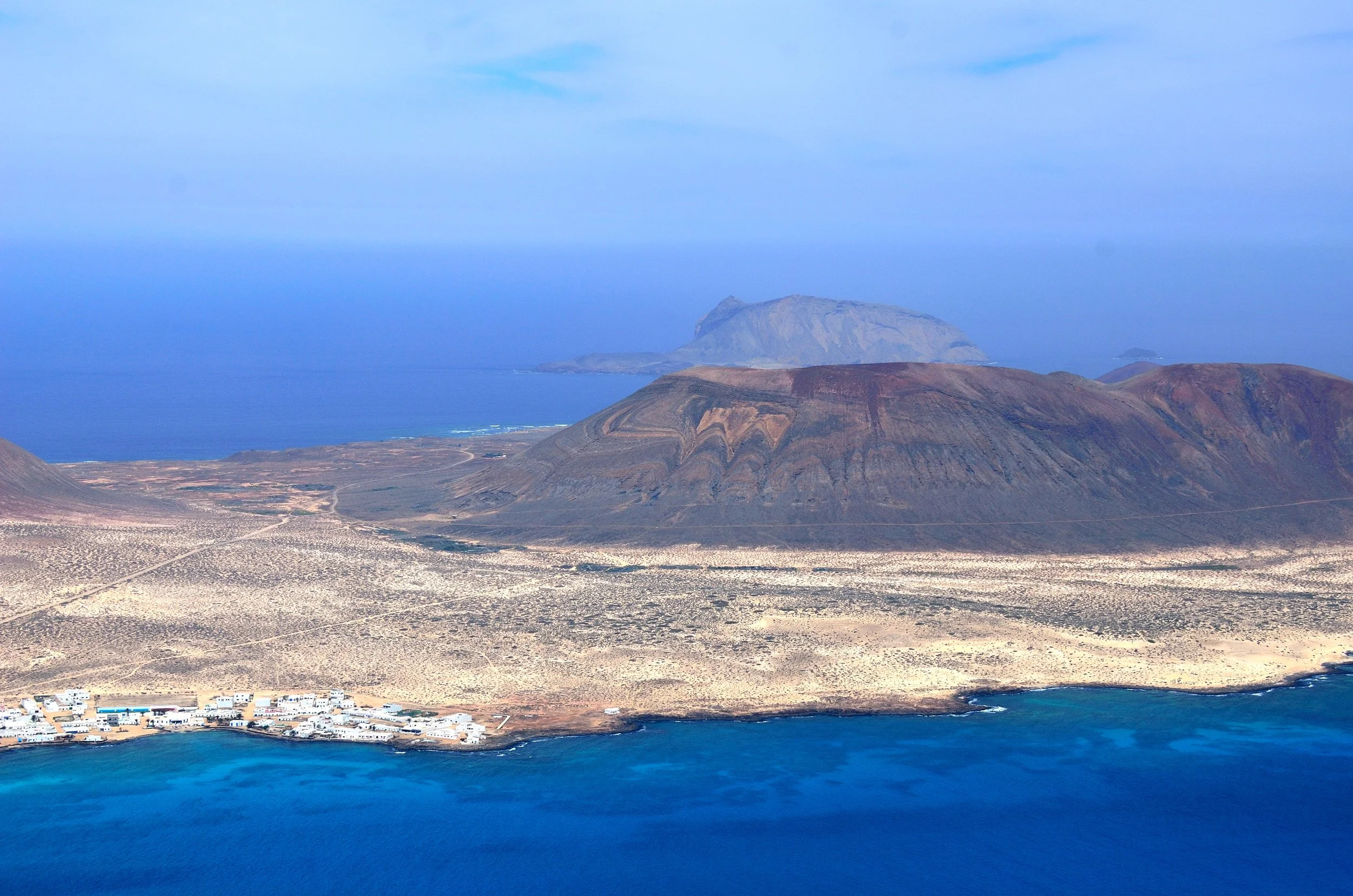
The serene and peaceful island of La Graciosa is located just north of Lanzarote. It was created by a volcanic hot spot and shows beautifully the type of landscape found throughout the region. The small village of Caleta del Sebo can be seen in the lower left of the picture. La Graciosa is one of the last islands in Europe without paved roads.

While the landscape looked desolate and hostile, the farmers of Lanzarote learned quickly how to take advantage of the rofe’s natural properties. As it turns out, rofe readily captures the dew and droplets from fog and allows water to filter through the gravelly ash to penetrate the fertile soil beneath. The volcanic ash is also rich in minerals, insulates the root zone of plants, prevents the evaporation of water, supresses weeds growth, minimizes soil erosion, and keeps plants free from diseases. In short, the volcanic eruptions created the perfect conditions for local vignerons to produce high-quality wines.

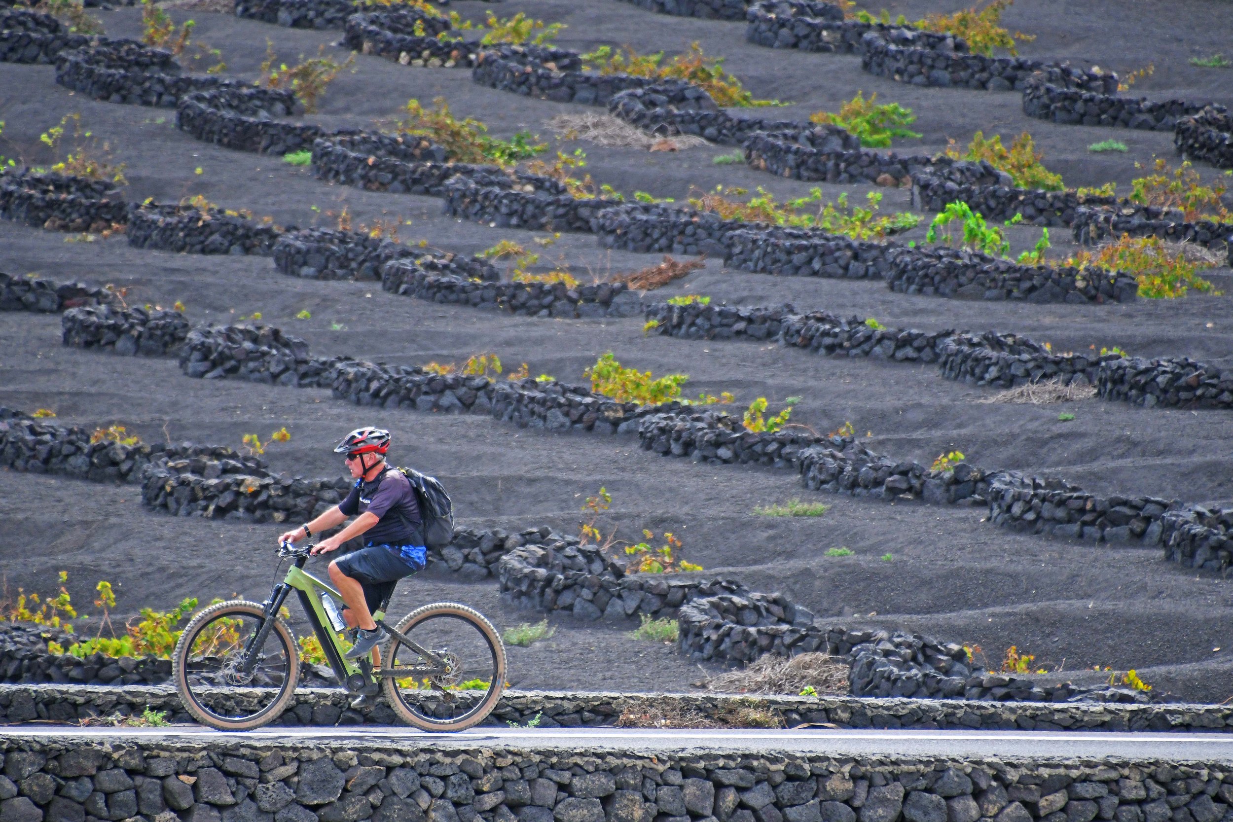
Many Europeans vacation on the island of Lanzarote to enjoy the hot climate, the surreal lunar landscape, the wine, and bike rides. I wonder what’s in the water bottle….

Over the course of three centuries, the vignerons of Lanzarote have shaped their volcanic environment to create an otherworldly but sustainable landscape. Thousands of hand-dug pits, each containing two grapevine bushes, are scattered throughout the island’s hills and valleys.

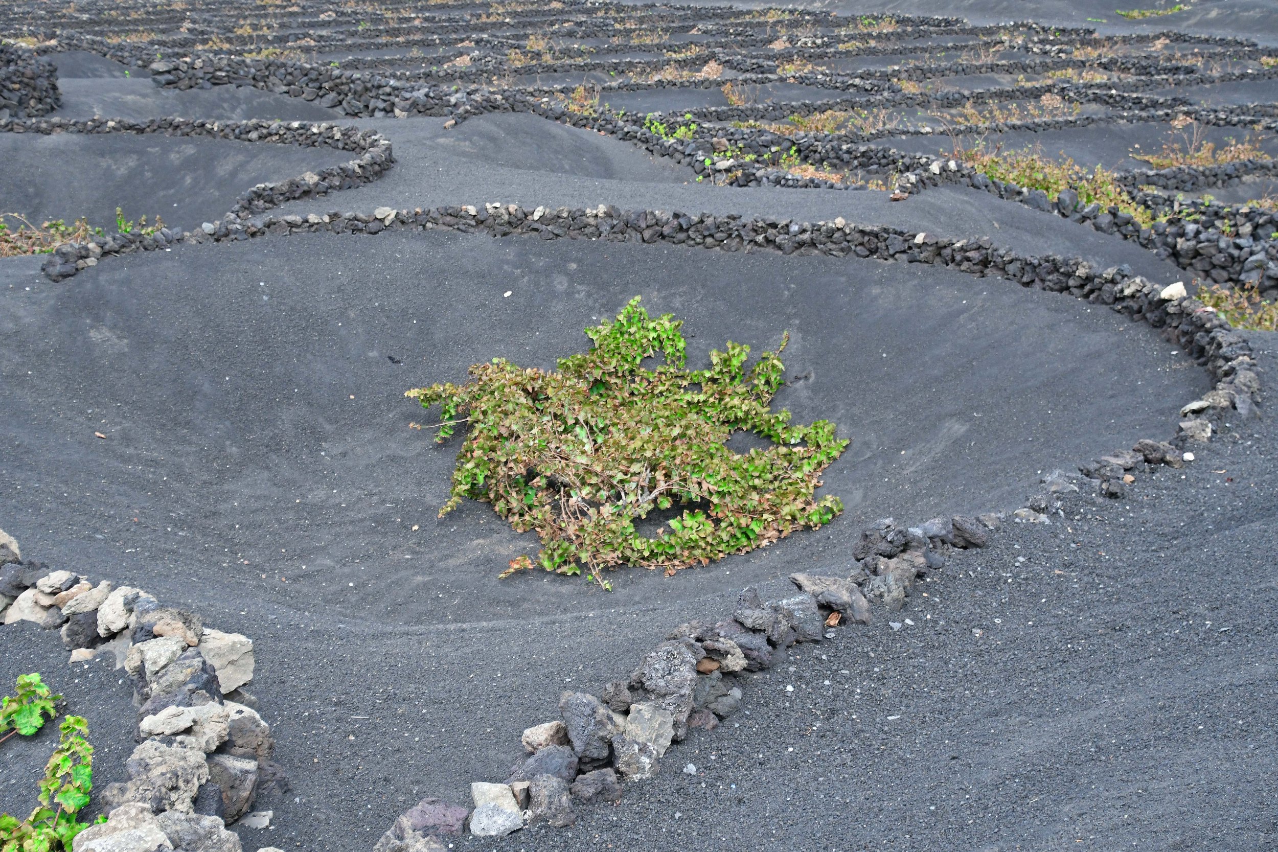
Malvasia grape vines are planted into the fertile soil at the bottom of a hand-dug pit. The walls of the pit create the perfect microclimate for the production of high quality wines.

Protected from the prevailing trade winds by semi-circles of volcanic rock, the ancient Malvasia grape variety thrives in the unique microclimates created by the hard-working farmers on the island. While the grapes produced by the vines are small and low yielding, they produce a wine with unparalleled balance, flavour, and perfume.

Camel riding among Lanzarote’s craters is a popular tourist activity.

Perhaps we don’t always need lemons in our lives to create something positive and special, but in the case of Lanzarote’s vignerons, 6 disastrous years of volcanic eruptions turned out to be a blessing in disguise. In a remarkable adaptation to a changed environment, the farmers on Lanzarote were able to turn a seemingly hopeless situation into a success story – and, perhaps because of my horticultural background, I just knew I had to write this one.

~ RT

December 18, 2023 /Rhyan Thomas
Comment

A rare Amazon River dolphin (Inia geoffrensis) in the Rio Negro, Amazonas State, Brazil. Pink dolphins, also called boto, start out with grey skin, but abrasions caused by swimming through flooded forests and fighting among males will expose the underlying pink skin.

Rio Negro, Amazonia, Brazil

March 11, 2023 by Rhyan Thomas

Even if you were geographically challenged, you will probably know that the Amazon River empties into the Atlantic Ocean. But you may not know, that it wasn’t always that way. Until 15 million years ago, the water in the Amazon Basin drained into the Pacific. In spectacular fashion, the ancestors (most likely toothed whales) of the famous Amazon River dolphins migrated into the interior from the Pacific, where they lived in the inland seas of South America for millennia after the rising Andes mountains blocked access to the Pacific. In isolation, they “learned” to live in fresh water and evolved into a totally different species. When the Amazon finally drained into the Atlantic, the river dolphins stayed and never found the need to return to the ocean.

The Amazon River dolphin (Inia geoffrensis), also called “boto”, is one of four river dolphin sub-species that can be found in the Amazon basin. While there are minor differences among the sub-species, they are very similar in the way they live, hunt, and reproduce in the murky waters of the world’s largest rain forest.

The flooded Amazonian rain forest at night during rainy season. The female botos and their babies retreat to this part of the river for protection and to catch fish. The male botos mostly stay in the open part of the Amazon.

The river dolphins have adapted beautifully to their environment. As they cruised through the flooded forests of Amazonia in search for food or to seek protection during the rainy season, the botos developed bodies that are half the size of their distant cousins, the bottlenose dolphins (Tursiops truncatus). The river dolphins also have vertebrae that are flexible, allowing the botos to turn their heads 90 degr. and move effortlessly under water among the trees and rocks. The echolocation also differs from that of the bottlenose dolphin. The clicks the botos emits to locate prey and obstacles are less loud and more frequent than those required by the bottlenose in the open seas.   

A typical ribereños home along the Acará River near Belem, Para State, Brazil.

Despite the fact that most Amazon river dolphins have a pink colour, they are actually grey when they are young. It is mostly the males that show their underlying pink skin colour after they have rubbed off their grey outer layer on trees and rocks in the flooded forests and fought other males for access to females. The more pink the dolphins show, the older (or more aggressive) they generally are. In the wild, botos live on average between 10 and 30 years. A river dolphin typically eats about 5% of its body weight in fish, crabs, and turtles per day.

The fish market in the town of Belem, Para State, is one of many places where ribereños sell the fish caught in the Amazon tributaries. The vultures on the roof tops can hardly wait for the next fishing boat to arrive.

Sadly, as in so many parts of the world, human/animal conflicts are also affecting the river dolphin population in the Amazon. The ribereños or river people (see also my essay “Amazon Basin, Brazil” in Archived Stories VI), who live in shacks and plain wooden cabins on stilts, subsist along the shoreline of the mighty Amazon. They rely on the same fish that the boto hunts for its survival. Frustrated by an ever diminishing catch and destroyed nets, many river dolphins are killed each year. Fishermen also kill botos for catfish bait. While this is a banned practice, the chances of being caught along this 7,000 km (4,350 mi) long river by the environmental police (IBAMA) are negligible, so the slaughter continues. Other threats the botos face include mercury poisoning from illegal gold extraction and loss of habitat from the construction of hydro electric dams.

The Amazon River dolphin is a critically endangered species. Their dwindling numbers (94% population loss since 2000) are caused by water pollution, overfishing, and killing by fishermen who use the dolphins’ meat as bait for catfish. A boto uses its teeth and strong jaws to crack open the shells of freshwater crabs and turtles. The colour of the water in this picture is caused by decomposed organic matter from the rain forest and is normal for the Rio Negro.

Because of muddy waters, the impenetrable flooded forests, and thousands of tributaries in the Amazon basin, it is almost impossible to know accurate population numbers. Recent estimates range from 2,000 to 10,000 dolphins remaining. The few studies that have been done show that the boto population in the Amazon is decimated by approximately 50% every 10 years. Restoring the river dolphin population is a slow and tedious process. Females carry their babies for 14 months and then nurse for another 2 years. As a result, female botos only reproduce every 3 to 5 years. Given the low population and many challenges the botos face in the basin, the rare Amazon river dolphin has now been categorized on the IUCN Red List as an endangered species.

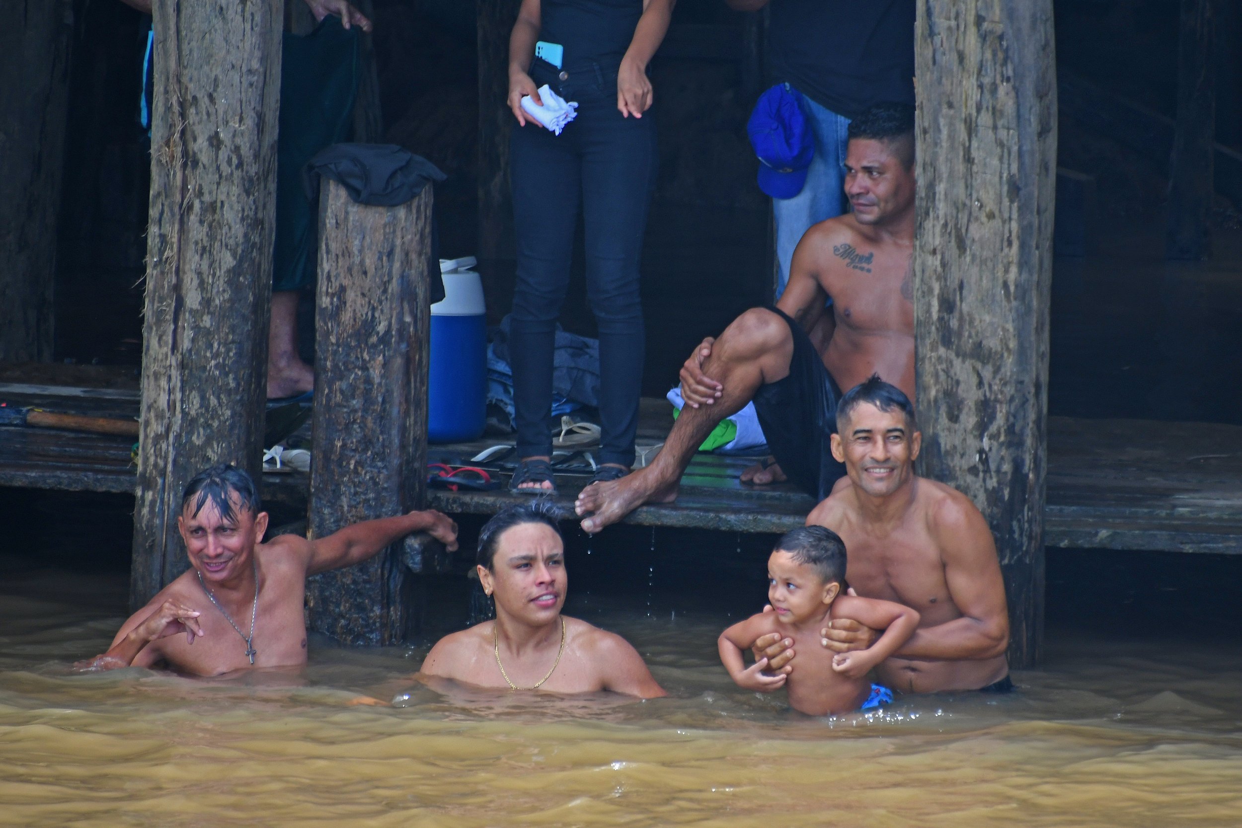
Members of a local ribereños community take a dip to cool off under a dock along the Acará River

On a more positive note, there are numerous environmental initiatives under way among the ribereños communities up and down the Amazon River. A successful example of sustainable resource management is the Mamiraua Biosphere Reserve on the Solimões River, 1,400 km (900 mi) from the mouth of the Amazon. In this initiative, the combination of quota-controlled harvesting of fish, increased surveillance of the river to prevent poaching and illegal fishing, and population monitoring have led to a dramatic increase in fish stocks and have raised hopes that, given the right approach, a livelihood derived from fishing the Amazon River can be sustained for generations to come.

One can only hope that the same kind of determination, cooperation, and insight will be employed to save the Amazon River dolphin and bring the boto back from the brink of extinction.

 ~ RT

March 11, 2023 /Rhyan Thomas
Comment

Mountain Range on Anvers Island, Antarctic Peninsula, Antarctica

Antarctic Peninsula, Antarctica

February 08, 2023 by Rhyan Thomas

If the earth were flat, this is the place where you are most likely to fall off the edge. For those of us who like First World comforts, the euphemism “end of the world” is a kind reference to Antarctica. This continent at the bottom of our globe truly is a place of extremes: it is the driest, coldest, highest (average elevation), windiest, and most remote place on earth. It also is the most beautiful (my opinion) and dismal (depending on the timing of your visit) place you can ever visit. Come on a clear summer day when the sun never sets, and you’ll find solitude among ice-covered mountains, dry valleys, and spectacular icebergs. Come on a cold winter day when darkness envelopes you and blizzards blur your vision, you can’t see the hand in front of your eyes and exposed skin will freeze in a matter of seconds, and you will not be able to think of a more miserable place on earth. It is at this place of beauty and danger that our global weather patterns are born, the world’s ocean currents originate, and 70% of the earth’s fresh water is stored.

The Antarctic continent, which is roughly the size of Australia, was avoided and ignored until just 200 years ago when the Antarctic Peninsula was first sighted. The discovery of land just south of South America unleashed a mad rush to commercially exploit the enormous whale and seal populations to the point when several marine life species were hunted close to extinction. Simultaneously, a global rush started to become the first country to reach the south pole. In terms of public interest, the race to conquer and claim 90 degr south can only be compared to the space race of the 1960s. Many expeditions by brave explorers were launched in the 19th century, but it wasn’t until 1911, barely 100 years ago, that the Norwegian Roald Amundsen became the first human to set foot on the southern-most location on earth.

Male killer whale (Orcinus orca) at maximum speed. As a penguin or seal, you don’t want to see this racing towards you. Killer whales hunt in pods. They are known to bump ice flows from below to dislodge their prey. Males are easily identified by their 2 m (6.5 ft) tall dorsal fins.

This is all to say that Antarctica is a remarkable place, poorly understood and explored, with much to offer to humankind. It still is a place where you can get terribly lost and die quickly without even trying. Antarctica is also a place that, after millennia of quiet, unnoticed existence, is crumbling before our eyes. It’s disintegration, which all reputable climate scientists agree upon has now started, has the potential to cause great suffering for all life on earth and result in millions of environmental refugees. Still, despite the available evidence and the known dire consequences of a climate catastrophe, there still are too many people all around the world who are either unaware of the facts or deny the undeniable. They look at news about the latest drought, heatwave, flooding, or polar vortex and blame “Mother Nature”.

A massive tabular iceberg in the evening light. Once part of a giant ice shelf resting on ocean water, this berg separated and will float in the open ocean and melt for years while contributing to the ongoing global rise in sea levels. The portion of these icebergs we can see, can be 100 m (300 ft) tall. Ninety percent of the iceberg mass is below sea level and cannot be seen.

At the heart of the threat our world is facing are the enormous ice shelves at the edges of the Antarctic continent. They are the proverbial canary in the goldmine. Due to warming sea temperatures in the Southern Ocean (mostly in the western Antarctic), the ice shelves, which extend and float on top of the ocean surface, have started to disintegrate. They cannot withstand the warm ocean water melting the ice from below. Eventually, huge tabular icebergs carve off the ice shelves and float out to sea where they survive for years before melting and contributing to a rise in sea levels. As an indication of size, the tabular iceberg known as B15 contained enough fresh water to replace the Nile River’s water volume for 75 years. The ice shelves along the continent’s fringes, some of which are the size of entire countries (e.g., the Ross Ice Shelf is the size of France or the size of Canada’s Yukon Territory), act as barriers which hold back the massive interior polar glaciers that rest on bedrock. With the ice shelves gone, gravity will allow the glaciers to slide down the elevated bedrock towards the ocean at a rate 10 times faster than the current speed.

Waterfalls created by melting glacier ice in Admiralty Bay on King George Island, Antarctica. So far, 1/3 of the global sea level rise can be attributed to melting glaciers.

What is warming the Southern Ocean? There is no doubt that high CO2 levels in the atmosphere are, at least indirectly, contributing to the temperature increases in the world’s oceans. The last time the world experienced CO2 concentrations as high as current levels (410 ppm) was 3 million years ago. At that time the global air temperature was 5 degrees warmer than is is now. Luckily, the oceans are acting as enormous heat sinks. Scientists believe that 93% of the heat generated by greenhouse gases is absorbed by the world’s largest bodies of water but by now, this has resulted in elevated ocean surface temperatures, globally.

Gentoo penguins (Pygoscelis papua) on an ice flow in the Gerlache Strait, Antarctic Peninsula.

With the amount of CO2 humans have already pumped into the atmosphere through the burning of fossil fuels, a global sea level rise (SLR) of 50 cm during the next 10 to 20 years will be unavoidable. Given that CO2 will linger in the atmosphere for 1,000 to 2,000 years, even a concerted global effort resulting in a sudden lowering of greenhouse emissions will not prevent the scourge of coastal flooding. It is believed that 100-year floods will become annual events already at 30 cm SLR. Believing the science, the Singaporean government will be investing US $120 billion to protect the city state from expected flooding by building a barrier along the shoreline in the years to come.

A large chinstrap peguin (Pygoscelis antarcticus) colony at the entrance to the caldera of Deception Island, South Shetland Islands, Antarctica. The island is an active volcano. The red colour is oxidized iron from the latest eruption (1969) while the green colour shows the presence of lichen.

Is it too late to halt rising seas levels? I guess the answer is a matter of degree. Since 1900, sea levels have already risen by 32 cm and we are, as mentioned earlier, moving towards 50 cm SLR at a rapid rate. What is already “in the pipeline” can no longer be undone. However, we still have a chance to avoid a potentially catastrophic SLR of 15 m by 2300, for example. Humans currently pump 40 billion tons of CO2 into the atmosphere and there is no indication that the trend is slowing. The only time CO2 emissions declined recently was in 2020 during COVID, but this abnormality in an otherwise rising trend was very short-lived.

An iceberg from a fragmented ice shelf is lit up by the evening sun near Anvers Island, Antarctic Peninsula.

As our ship glides past massive penguin colonies and icebergs that were shaped into pieces of art by waves and wind, I wonder how many future generations of tourists will be able to marvel at sights like these. Then I see tabular icebergs in the distance, massive in size and gleaming in the setting sun. Suddenly the answer seems to be clear: not many.

This year, 100,000 tourists will visit Antarctica - a record. It used to sadden me when thousands of tourists stream into the last remote places on earth. Not in Antarctica. In my opinion, the more people see the effects of climate change first hand, the better for the world.

Waves splash against the base of a large floating ice shelf in the Drake Passage between Cape Horn and Antarctica.

You may not fall off the earth’s edge in Antarctica, but intrinsically you know, the process you are witnessing here may soon lead to more severe coastal flooding around the globe.

The canary is not doing well.

More pictures can be seen on this website on the page “Gallery Archive - Antarctica I”.

 ~ RT


February 08, 2023 /Rhyan Thomas
Comment

The famous “Calendabra of the Andes” located on the slopes of the Paracas Peninsula facing the Pacific Ocean.

Paracas Peninsula, Peru

February 07, 2023 by Rhyan Thomas

I asked Jose if we could see the famous “Calendabra of the Andes” up-close. “Unfortunately,” he replied, “the ministry of tourism prohibits us from taking tourists to the site. The geoglyph is fragile and can only be observed from a boat.” Jose’s quick response tells me that I am not the first person to ask that question.

The Calendabra we were talking about is an immense 2,500 years old geoglyph etched 0.60 m (2 feet) deep into the petrified sand on the Paracas Peninsula along the Peruvian coast. Because it was created on a sloped hill facing the Pacific Ocean, the geoglyph can be seen from 19 km (12 mi) offshore, but the reason for it’s creation is still a mystery.

There are many theories, of course. Some say it was meant as a beacon to sailors when far from shore while others believe it is a lightning rod for the god Viracocha, a god much worshipped by the Paracas people who are believed to be responsible for creating this work of art. Some archeologists see a symbolized trident in the Calendabra while others see the geoglyph resemble a Jimsonweed (Datura stramonium), a plant that causes hallucinations and is known for its medicinal properties. Personally, I think it looks very much like a three-armed candlestick. Why can’t we leave it at that?

It is beautiful where the desert meet the ocean. Sea birds nest in these cliffs at the edge of the Paracas Peninsula.

The fact that the geoglyph can still be seen and admired almost 2,500 years after its creation is, in my opinion, nothing short of a miracle. How can a figure that is etched in sand last this long? “The last time it rained was in 1998” Jose said, “the entire west coast of Peru is a desert.” Ok, I can see how a geoglyph can survive a long time in a climate like this. After all, the Nazca Lines, which are a mere 200 km (130 mi) from this site, are still clearly visible, too.

Local fishermen pulling in their harvest not far from the Candelabra.

The greatest danger to the Peruvian geoglyphs’ survival are neither rain nor wind (even though a changing climate might cause them to be washed away, eventually). The greatest treat is vandalism. Despite being located inside a National Park Reserve, the Calendabra can easily be reached, especially by ATV, 4x4 trucks, and dirt bikes – and they cause much damage. Even hikers just walking through the site leave footprints. Most often, the vandalism is caused by young people who are either frustrated with life, bored out of their minds or whose playfulness is seriously misguided. Even Greenpeace, an organization that should know better than to trample across sacred sites, have been caught damaging local geoglyphs.

A closeup view of the Candelabra (…made possible by my powerful zoom lens) reveals animal tracks and footprint damage from uninvited visitors.

I have come to see the Calendabra several times now, always a few years apart. Luckily, the geoglyph always looks the same. However, now that I know that vandalism occurs on a more or less frequent basis, and the monument is being repaired as soon as it is damaged, I am no longer surprised by its flawless appearance. Fortunately, for visitors, the mystery of the Candelabra’s purpose and longevity, remains.

More pictures can be seen on this website on the page “Gallery Archive - Central & South Amercia III”.

~ RT

February 07, 2023 /Rhyan Thomas
Comment
This is a female “Juan Fernandez firecrown” (Sephanoides fernandensis). A VERY rare bird, indeed. While walking along the boardwalk, she perched on a branch in front of me and posed for a picture. The male of this species is bright red. Currently, o…

This is a female “Juan Fernandez firecrown” (Sephanoides fernandensis). A VERY rare bird, indeed. While walking along the boardwalk, she perched on a branch in front of me and posed for a picture. The male of this species is bright red. Currently, only +/- 400 of this species remain alive on earth.

Robinson Crusoe Island, Chile

March 29, 2020 by Rhyan Thomas

Poor Alexander was faced with a tough choice: stay on an unseaworthy buccaneer ship OR get left on an isolated island in the South Pacific and perhaps die of hunger and thirst. He chose the latter.

It was in the year 1704 when Thomas Stradling, the captain of the Cinque Ports, had enough of Alexander Selkirk’s dissent and complaints. Before he knew it, the Scotsman was marooned on a deserted island with a musket, some gun powder, carpenter’s tools, a knife and a Bible. While the Cinque Ports sank shortly after, Alexander carved out a living for himself on an uninhabited island in the Juan Fernandez Archipelago, 670 km (416 mi) off the west coast of Chile. He survived four years and four months in isolation until William Dampier, the overall commander of the ill-fated Cinque Ports’ expedition, returned to the island to see if Alexander was still alive. To his surprise, Alexander was doing well despite his hardship, surviving on fish, berries, and wild goats. Wearing goat skins and looking a little wild, he was returned to London where he became a celebrity.

Robinson Crusoe Island is part of Chile and a UNESCO World Biosphere Reserve.

It is believed that the British author Daniel Dafoe learned about Alexander’s adventure and based his famous novel Robinson Crusoe on the story. The book was published in 1719 and was so successful, that 4 editions sold out in the first year after publication. Since then, Robinson Crusoe has become the second-most translated book (after the Bible) in history.

Of course, there are discrepancies between fact and fiction, but they were not reason enough for the Chilean Government not to change the name of the island from Más a Tierra to Robinson Crusoe Island in 1966. This beautiful and isolated piece of earth is now home to over 800 Chileans who eek out a living by catching spiny lobsters and offering recreational diving services to tourists in the island’s crystal clear sub-tropical waters.

In 1977, Robinson Crusoe Island was recognized by UNESCO as a World Biosphere Reserve, making it also a destination for researchers to whom the island’s endemic flora and fauna is of extreme scientific importance. The relative lack of outside interference has allowed plants, insects and birds on Robinson Crusoe Island to evolve in almost total isolation. It is a living laboratory similar to the famous Galapagos Islands.

This valley is home to many endemic species which can only be found on Robinson Crusoe Island. In the foreground is “giant rhubarb” or “dinosaur food” (Gunnera peltata). The leaves can reach a diameter of up to 2 m (6.5 ft).

This valley is home to many endemic species which can only be found on Robinson Crusoe Island. In the foreground is “giant rhubarb” or “dinosaur food” (Gunnera peltata). The leaves can reach a diameter of up to 2 m (6.5 ft).

An example of a rare species that is unique to the island and found nowhere else on earth is the Juan Fernandez Firecrown hummingbird. With a mere 400 specimens left, it is considered critically endangered. In the 300 years since Alexander’s captivity on the island, rats, domesticated cats and dogs as well as invasive plant species such as eucalyptus trees, blackberry bushes and pine trees have changed the island’s natural habitat, making it increasingly difficult for the tiny birds to find sustenance and raise their young. It is a familiar, but nevertheless painful story for this and other rare species.

As I sit on the ground and look through the view finder of my camera, trying to capture a photo of these rare hummingbirds, something passes between my legs. Perplexed, I look and see a cat beside me. I am surprised and angry to see this domesticated predator run free in this National Park and biosphere reserve. Surely, given all we know about the devastating effects introduced species have on the natural world and all the efforts made to save the Juan Fernandez Firecrown from extinction, why is this cat not at home chewing on Meow Mix?

Robinson Crusoe Island is home to over 800 Chileans who catch spiny lobsters for a living and offer recreational diving services to the few tourists that find their way to this remote island. This road serves as a main tsunami escape route during an emergency.

I am certain Alexander didn’t have these thoughts when he was trying to survive on the island. In the early 18th century, protecting biospheres was a foreign concept, especially to a lawless buccaneer like Mr. Selkirk. But the world is a different place now, and we have to do whatever we can to preserve what is left of the world’s relatively intact ecosystems. I think I’ll take my weed eater and chainsaw to Robinson Crusoe Island and hack away at the blackberries, cut down eucalyptus trees and start an educational campaign for pet owners. That would be a worthwhile retirement project, don’t you think?

More pictures can be seen on this website on the page “Gallery Archive - Central & South America III”.

~ RT

March 29, 2020 /Rhyan Thomas
Comment
The Nazcan people of Peru carved rectangles 30 cm (1 ft) deep into the desert floor and up hillsides two millennia ago. This was done by removing rocks and piling them in straight lines to form the lines' edges. The lines, rectangles, trapezoids and…

The Nazcan people of Peru carved rectangles 30 cm (1 ft) deep into the desert floor and up hillsides two millennia ago. This was done by removing rocks and piling them in straight lines to form the lines' edges. The lines, rectangles, trapezoids and nature images at Nazca were created over a 700 year period. They overlap, erase, and cross each other. While many theories exist about the purpose for the lines, the archaeologists still don’t have a definite answer.

Nazca Lines, Paracas, Peru

March 28, 2020 by Rhyan Thomas

I am confused. The Nazca Lines, which were created in southern Peru some 2,000 years ago (long before the age of flight) can only be seen and fully appreciated from the air. Why create art that nobody can see? The Lines not only baffled my mind, they also have perplexed generations of scientists and armchair archaeologists alike.

It all started when someone flew his plane over the Sachura Desert in the 1920s and noticed perfectly straight lines up to 50 km (30 mi) long and giant figures etched into the dry desert floor. The figures, which are called geoglyphs, are up to 280 m (920 ft) long. They depict birds, fish, humans, and even spiders, are huge and can only be seen from the air. Their discovery, after the site has been shrouded in obscurity for 15 centuries, launched a myriad of investigations which, up to the present, have tried to explain how and why the geoglyphs were created. Not an easy task because pre-Columbian civilisations in South America left no written records of their lives and cultures.

The Pan-American Highway starts in Alaska and ends in Patagonia, the southernmost tip of South America. The highway goes right through the Nazca Lines. The lines became a UNESCO World Heritage Site in 1994. The more than 75,000 ha (185,000 acres) la…

The Pan-American Highway starts in Alaska and ends in Patagonia, the southernmost tip of South America. The highway goes right through the Nazca Lines. The lines became a UNESCO World Heritage Site in 1994. The more than 75,000 ha (185,000 acres) large site in the Sachura Desert is too big to monitor effectively. Vandalism can be seen in many places.

We now know that the geoglyphs were mostly constructed by the Nazcan people, a pre-Columbian culture in southern Peru, between 200 BC and 500 AD. Hypotheses abound about the purpose and meaning of the over 800 straight lines and 70 animal and plant figures on the desert floor. They range from landing strips for alien spacecraft to indicators for subterranean aquifers to sites for spiritual rituals. Using cross-interpretations among the Nazca Lines, Nazca pottery designs and Nazca textile art, the consensus was reached that water and fertility were of primary importance to the Nazca culture. Since the Sachura Desert is one of the harshest and driest places on earth (the desert receives less than 1” of rain per year), it would make sense that the artwork on the desert floor was created to appease the gods, pray for rain and crop success and serve as places of worship.

Of course, this does not explain the enormous size of the geoglyphs and how such perfect designs could have been achieved without help from above. Perhaps we must wait for a new generation of scientists to take over before out-of-the-box thinking can solve one of the most baffling archaeological mysteries on our planet.  

More pictures can be seen on this website on the page “Gallery Archive - Central & South America III”.

~ RT

March 28, 2020 /Rhyan Thomas
Comment
“Devil’s Throat” is the most spectacular of all the falls at Iguazu. The volume of water passing over the falls varies greatly throughout the year, depending on the season. Iguazu is the largest waterfall in the world because is has the most discree…

“Devil’s Throat” is the most spectacular of all the falls at Iguazu. The volume of water passing over the falls varies greatly throughout the year, depending on the season. Iguazu is the largest waterfall in the world because is has the most discreet (individual) falls: over 270

Iguazu Falls, Brazil & Argentina

March 28, 2020 by Rhyan Thomas

Mornings are best. As the sun ascends beyond the treetops and floods the landscape with its golden light, I sneak past the “No Entry” sign and enter the park without anybody noticing. The birds are out during this time of day, making enough noise as if it were their job to wake up the animals of the rainforest. Beyond the deep-throated croaking calls of curious toucans looking down on me from their perches in the treetops, I can hear the constant, thundering, majestic rush of the falls. It is an ethereal sound. A natural, familiar reverberation that connects me to other lifetimes when this forest was home to the Guarani Indians for thousands of years. The Spanish-Portuguese invasion of their territory in the 16th and 17th centuries put an end to their way of life. When Jesuits established missions in the area, they were initially rejected by the Guarani. But when ruthless slave traders decimated the Indian population, the Guarani befriended the Jesuits who taught them a new way of life through farming and protected them from the seeming inevitability of slavery.

Diaethria clymena, commonly known as “Cramer’s 88”, is a neo-tropical butterfly native to Argentina, Brazil, Peru, and Paraguay. Iguazu Falls National Park is famous for its high butterfly population.

Diaethria clymena, commonly known as “Cramer’s 88”, is a neo-tropical butterfly native to Argentina, Brazil, Peru, and Paraguay. Iguazu Falls National Park is famous for its high butterfly population.

Iguazu Falls National Park opens at 8:00 am. As thousands of visitors stream through the gates with their plastic water bottles, cellphones and baby carriages, the mood changes. It is then that the magic, evocations, and enchantments disappear. I can no longer hear the toucans, the rushing waters, and ancient Indian voices in the wind. Nature, the very thing people seek in this National Park, takes a back seat and is drowned out by tour busses with diesel engines, loudspeakers, and vendors. It can be seen, but nature can no longer be felt. As I jostle for position on the various viewing platforms, I can take my photos without interference. It helps to be tall. Still, it all feels very mechanical: get into position, take the photo and get out. The magic from this morning is gone.

Without a doubt, the Iguazu Falls in Argentina are impressive, and I am glad I came to experience the largest waterfalls in the world. But the majesty of the place can only be felt without crowds. I am not suggesting you trespass as I did, but show up early enough to miss the onslaught of tourists. It is only then that you can truly connect to this place with your soul.

More pictures can be seen on this website on the page “Gallery Archive - Central & South America II”.

~ RT

March 28, 2020 /Rhyan Thomas
Comment
Sunset over Amazonia

Sunset over Amazonia

Amazon Basin, Brazil

March 28, 2020 by Rhyan Thomas

Dusk is an abbreviated affair at the equator. You must be quick if you want to take pictures of the setting sun as it hovers just above the majestic Amazon River or the seemingly endless tropical rainforest. And after the sun has plunged into the brown flood waters of the Amazon, darkness blankets the landscape quickly, accompanied by all of the eerie sounds and shadowy movements the largest jungle on earth has to offer.

As humans, we feel small in this place, and I wonder what it must have been like for the first European explorers and colonists who set foot into this forest a couple of centuries ago. Many entered and have never been seen again. Surely, they knew nothing about the jungle’s most prominent residents: swift jaguars, constricting boas, spiky trees, deadly spiders, hungry alligators, Amazon Indians with poisoned darts and billions of disease-carrying insects. Since these first expeditions and excursions into this terrifying environment took place, it is important to note that not much has changed for about 80% of the Amazonian Rainforest. In the jungle, the same beauty and terror reign in the year 2020, as it did then.

Of course, the Amazon River is at the very heart of this massive ecosystem. With thousands of tributaries originating in 6 countries (Brazil, Peru, Colombia, Venezuela, Ecuador, and Bolivia), the 6,437 km (4,000 mi) long river system is home to 10% of the world’s species and 20% of the world’s bird species. The Amazon spills 20% of the world’s river volume into the ocean, carrying its brown discharge eastward across the Atlantic almost as far as the west coast of Africa.

It may surprise you that the Amazon River basin is nearly 2/3 the size of Canada and home to approximately 28 million people. The vast majority of its residents live in cities that have been established along the riverbanks - Belem, Manaus, Santarem, Macapa, Parintins, Fabatinga, and Iquitos are just a few examples of major population centers. While the cities offer work and are home to millions of people, many towns are islands of civilization in the midst of the jungle and have no roads leading in or out. Access is only possible by air or boat. In fact, there are no bridges across the Amazon River anywhere for its entire length. The flooded forest during the rainy season makes building bridges an impossibility.

At the edge of the jungle and away from civilization and the hustle and bustle of city life, you can only make out the occasional light along the thousands of kilometers of riverbank. Out here, in the remote parts of the Amazon, generators provide electricity to the rustic cabins of the ribereños, the River People. An independent and transient folk, the ribereños eek out a subsistent living for their families along the world’s longest river. Over time, and not unlike most Amazonian indigenous tribes, the River People have adapted to life in the forest. Fish, acai, Brazil nuts, wild fruits from the jungle and whatever crops they can produce on their meagre land base constitute the lion’s share of their food intake and income. Smaller animals are also part of their diet. Armadillos, tapir, opossums, and small rodents are hunted and represent an important source of protein. The ribereños know how to survive in this unforgiving environment.

At the Poi Bumba Festival in Parintins, State of Amazonas, Brazil

Ethnically, the ribereños consist of detribalized natives, mestizos, and those of European descent. As a matter of life and death, children growing up along the river must learn to swim and operate dugout canoes at a very early age. Given the lack of roads, this giant waterway with its many inlets and sloughs, is the ribereños’ lifeline and transport system. Boats are used to drop the kids off at the nearest one-room school, to get the harvest to market, to go to church, to pick up supplies in the village, and to visit friends and family up and down the Amazon. Through our conditioned eyes, the ribereños look poor and backwards, however, those impressions are misleading. While living on the fringes of the civilized world, with cellphones in hand and satellite dishes on the roofs of their cabins, the ribereños know what is going on in the outside world.

The same is true, but only to varying degrees, for the indigenous Indian tribes in the Amazon. Without a doubt, they represent the most vulnerable population group in the country of Brazil, which occupies 60% of the Amazon basin. Hunted by ruthless soybean farmers and displaced by illegal gold miners who invade native lands, the tribes’ very existence and traditional way of life are severely threatened. The populist, right-wing government of President Jair Bolsonaro is not only unsupportive of the Amazon Indians, it is actually in the process of rolling back indigenous rights while encouraging religious groups to convert the “savages” to Christianity. The evangelicals are a crucial voting block in Brazil and very supportive of Bolsonaro’s efforts to “integrate these citizens” into modern society. It appears, not much has changed since the early days of colonization.

The bullet ant (Paraponera clavata) is one of the most feared ants in the Amazon. Contact with the ant is very painful and can be fatal. It is used by the indigenous tribes during initiation rituals for boys.

The bullet ant (Paraponera clavata) is one of the most feared ants in the Amazon. Contact with the ant is very painful and can be fatal. It is used by the indigenous tribes during initiation rituals for boys.

In a country where red traffic lights are a mere suggestion and the violation of laws goes unpunished, the exploitation of the Amazon basin has reached unprecedented levels. Native tribes are in the crossfire more than ever.  Literally, Indians are being killed because they are seen as a hindrance to the economic exploitation of the rainforest. As Cristiane Mazzetti of Greenpeace states: “Even in the face of an alarming scenario for the Amazon, with increased fires, deforestation, invasions of protected areas, and violence against Indigenous Peoples, the government hasn’t presented any consistent policy to protect the forest and its peoples; on the contrary, the government is taking the side of environmental crime.” For farmers, ranchers and miners, it’s open season for the rainforest. Aside from the lack of political will, it is very difficult and expensive to police the vast, remote, and sparsely populated areas of the rainforest, making this a lawless and relatively ungovernable part of the world.

To date, 17% of the Amazonian rainforest have been logged and burned and opened up to cattle ranching, soybean field production (80% of the Brazilian soybeans are used as cattle feed), and mining. Scientists believe that the destruction of 20 to 25% of the rainforest represents a threshold and the point of no return. At that level, the water cycle will be sufficiently disrupted (reduced evaporation of water vapour from the tree canopy results in diminished rainfall) to gradually turn the Amazon basin into a savanna.

A visit to the Amazon is as passionately enthralling as it is emotionally upsetting. To focus on one without at least acknowledging the other would be akin to burying your head in the sand. The bad news is that the political climate in Brazil is marked by division as much as it is in the USA and in many other parts of the world. The resulting populist agenda is driving the further destruction of the rainforest and causing much uncertainty for Brazil’s indigenous tribes. The good news is that the forest still functions. The animals are still there, the tribes are still practicing their traditions and the rains still flood the forest. Also, the world is very much aware of the dangers to the rainforest ecosystem and many brave people put their lives on the line to save it. Also, the European countries are leading the way in applying economic pressure on the Bolsonaro regime to change its way of managing the Amazon basin.

To catch the sunset and with my camera in hand, I am racing to the upper deck of our ship and just manage to see the last glimpses of the giant red ball dropping into the vastness of the life-giving Amazon river waters. This is one of those moments when you are as close to being filled with joy as you are to crying with grief. I have said many times that every one of my pictures could be a prayer. Nowhere has this been more true than in the Amazon.

More pictures can be seen on this website on the page “Gallery Archive - Central & South America II”.

~ RT

March 28, 2020 /Rhyan Thomas
Comment
The Flag Bearer, together with the Samba Master (not shown), lead the Samba School’s peagant into the Sambadrome in Rio De Janeiro. The role of the Flag Bearer is crucial as she sets the tone for the School’s performance and eventual rating by the j…

The Flag Bearer, together with the Samba Master (not shown), lead the Samba School’s peagant into the Sambadrome in Rio De Janeiro. The role of the Flag Bearer is crucial as she sets the tone for the School’s performance and eventual rating by the judges. This is the Flag Bearer of the “Unidos De Bangu” Samba School. Bangu is a middle class neighbourhood in the western part of Rio De Janeiro. The school is the fourth oldest Samba School in Brazil.

Carnival in Rio, Rio De Janeiro, Brazil

March 28, 2020 by Rhyan Thomas

When the Church fails its people, let Rio’s Carnival fight for the rights of women, blacks, gays, and indigenous minorities. As outlandish as this (my) statement may seem, in my brief time in Rio I have come to believe that it may be time for the biggest and most extravagant Carnival in the world to be a platform and sounding board for the rights of the poor and disadvantaged. For me, Rio was just another stop on my way to the Amazon, my next highlight on this trip. I had no idea how much the mood, atmosphere, and energy of this city would engulf me and transport me into another world.

After one year under the political leadership of the ultra-conservative President Jair Bolsonaro, who uses divisive racial rhetoric and came to power with the help of Christian institutions and an effective mis-information campaign on WhatsApp, a deeply divided Brazil has heard disturbing messages from the most prominent Samba Schools in Rio this weekend. (Samba is a Brazilian music and dance genre that has its roots in the West African slave trade and African religious traditions.) The schools’ messages came through loud and clear: stop the hate speech, racism, inequalities, and the persecution of minority religions. This evil is in the process of consuming Brazil at the hands of the “prophets of intolerance”.

Risen out of Rio’s favela communities (favelas are unregulated slum neighbourhoods in Brazil), Samba Schools have always found ways to address social inequalities in the realities of their lives through music, dancing, and parades. This year, however, they have stepped up their game. The right-wing political climate in Brazil and its devastating consequences for the country’s poor and racial minorities is under severe scrutiny. Criticism of Bolsonaro appears to be wide-spread, so much so that political activism is taking center-stage in many of the Schools’ Carnival presentations. Last year’s champion of this annual competition, the Mangueira Samba School for example, was depicting the second coming of Christ in its parade this past weekend. Mangueira, which is known to be outspoken in its messaging, tells the story of Jesus born in the favela who stands up to intolerance and injustice. The presentation envisions Jesus with a black face, indigenous blood, and the body of a woman. “This is the Christ of Mangueira,” says Manuela Oiticica who wrote the headline song for the Mangueira'sparade. “He died for those values…and these are the values we need to recover today.”

“The eyes that see everything, the vision of truth and justice.”

Mangueira’s message this year is that of fraternity, tolerance and love. Provocative in its presentation for sure, but also necessary for as long as Christian institutions can’t remember the true message of Jesus and find themselves caught up in the winds of ultra-right populism. Their moral outrage is more focussed on scantily clad women parading in the Carnival and public urination in the streets than the things that really matter.

Not everybody is enthralled by the Samba Schools’ peagants.

Not everybody is enthralled by the Samba Schools’ peagants.

At the end of my conversation with Marcia, a 50-year old Brazilian woman who lives in Rio, she points out to me the cultural and racial diversity of Brazil. “Counterfeit Brazilian passports are very much sought-after,” she said, “no matter what your background or the colour of our skin, here, you blend in and nobody will notice.” Still a cause for national shame after more than a century, Marcia points out that Brazil was the last country in the world to abolish the slave trade in 1888. Over 4.9 million slaves were brought here from West Africa to build churches, work in the sugar plantations and mining. The sins of the past still seem very recent and the humiliation and painful memories of those inhumane times have been passed on from generation to generation.

A slave master leading newly captured slaves to the ship.

Watching Rio’s Carnival Parade in the Sambadrome with 70,000 other people, I notice how the racial divide is still visible even here at this mega party: the majority of people in the viewing stands are white while the majority of people parading and dancing on the pavement below are black and clearly of African descent. Luiz Carlos Maximo of the Mangueira Samba School summarises the parade’s purpose beautifully: “Carnival is about joy…but the Samba Schools are reflecting what society is experiencing. They are talking about what the Brazilian people are living and suffering. And that’s the thing about samba – it sings about the saddest things, but with joy.” 

Carnival parade at the Sambadrome in Rio de Janeiro, Brazil

During this visit, I was only able to get a small taste of the Carnival experience in Rio and sadly, I did not get to watch and photograph the more provocative and meaningful parades. There is so much more to know and learn because the working class’ expressions of struggle and resistance are not limited to the parades at the Sambadrome: during much of the Carnival weekend, at night, there are approximately 300 blocos (neighbourhood street parties and performances) happening throughout Rio. As it seems, the entire city throbs and sways to the rhythm of drums and baile funk (a music genre derived from Samba). 

A samba school community is waiting to cheer for their parade team.

For somebody like me, who likes to be asleep by 9:30 pm, during my next visit I will definitely have to shift my priorities. As a local told me, you are always welcome to attend blocos in the various neighbourhoods – but remember, nothing happens before 11:30 at night and don’t expect to get home before 9 in the morning.

I think I am too old for that.

More pictures can be seen on this website on the page “Gallery Archive - Central & South America II”.

~ RT

March 28, 2020 /Rhyan Thomas
Comment
The mystery of icebergs in the Antarctic is enhanced by the fact that their beauty is created in total isolation. The elements are the artisans here. Crafted away from the eyes of the world, the icebergs’ existence goes mostly unnoticed, their beaut…

The mystery of icebergs in the Antarctic is enhanced by the fact that their beauty is created in total isolation. The elements are the artisans here. Crafted away from the eyes of the world, the icebergs’ existence goes mostly unnoticed, their beauty wasted on the eyes of penguins and whales.

Antarctica

March 28, 2020 by Rhyan Thomas

Unless you have a heart of stone, the beauty of Antarctica leaves you breathless and in awe. The wildness of the place transcends that of Alaska, touches your soul deeply and reminds us of an earth still unharmed by human intervention.

The beauty extends beyond the visual. A sense of serenity prevails as we travel through iceberg studded fjords and pass by frozen granite peaks surrounded by storm-chased dark clouds. Rather than distracting from the experience, the deafening noise of the penguin rookeries just adds to the other-worldly realization that we are visiting a very special place.

One of several Chilean research bases in the Palmer Archipelago on the Antarctic Peninsula.

Between 50,000 and 60,000 people come here every year. Many are scientists working on research bases, but most are carefully managed tourists. While this sounds like a lot of people, keep this in mind: Antarctica is enormous in size. If the continent’s ice-covered mountains and ice sheets were draped across the North Pole and the Arctic, they would reach as far south as Oslo in Norway and Anchorage in Alaska. In winter, the Antarctic continent increases to twice its size.

Only 0.4% of the frozen continent is not covered with ice. There is no permanent human habitation anywhere on the continent. With measured wind speeds of up to 300 km/h, a desert climate and temperatures dropping as low as -89 degr. C (-128.2 degr. F), it is no surprise that Antarctica has drawn as many adventurers to its shores as it has repelled.

Currently, there are 77 scientific bases operating in Antarctica, requiring much needed logistical support. From fuel to vegetables to books to garbage, everything must be brought in and taken out by airplanes and ships. The agreement covering all activities on the continent (including tourism) is a surprisingly short piece of inter-governmental legislation. The “Antarctic Treaty System” ratified in 1959 is an agreement originally signed by 12 countries committing Antarctica to be a “Natural Reserve Devoted to Peace and Science”. It forbids military activities on the continent and the exploitation of all lands and waters south of 60 degr Southern Latitude. The Treaty represents a blueprint for the “Peaceful Use, Freedom of Scientific Investigation and Cooperation” and is a rare example of how countries of the world can work together to achieve a common goal.  

By now, 56 countries are signatories of the Treaty. Decision-making privileges have been granted to 29 of these nations as they are engaged in substantial scientific research activity on the Antarctic continent. While scientific research initially focussed on the geology and biological diversity of the region, in recent years the research emphasis has shifted to almost exclusively deal with climate change and its effect on the Antarctic glaciers and eco systems.

Gentoo Penguin

Gentoo Penguin

Of course, as in most geographic regions around the globe, important threats are the driving force behind significant changes in the Antarctic. From the illegal exploitation of natural resources (e.g. fishing, sealing, whaling) to the introduction of exotic and invasive species and indirect human influence (e.g. pollutants, ozone depletion, climate change and ocean acidification), the Antarctic is witnessing profound changes. Just last week, on February 6th, the warmest air temperature in the history of weather monitoring in the Antarctic has been recorded at the Argentinian scientific base on the Antarctic Peninsula: 18.3 degr C (65 degr. F). Warming ocean currents destabilize huge ice shelves, causing icebergs the size of small countries to calve off while disrupting local ecosystems; some penguin colonies are seeing a 70% decline in populations; krill, the building block of all marine life in the Antarctic food chain, are no longer produced in sufficient quantities to support squid, fish, seals, penguins and whales; melting ice sheets change the salination of ocean water while raising sea levels world-wide. The list goes on.

While some political leaders deny the destructive power of climate change and use the ignorance of the voting public to pursue their own destructive agenda, the rest of the world is moving on, trying frantically to save threatened species and curb greenhouse gas emissions. No ecosystem on earth collapses in isolation – everything is interconnected. But as the success of the Montreal Protocol of 1987 (which was designed to curb the use of substances that destroy the earth’s ozone layer) has shown, positive change can happen fast.  Amazingly, politicians listened to the scientists’ warnings and the Protocol was ratified by all countries on earth. Since then, the agreement has not only halted the disintegration of the ozone layer but also contributed to its gradual healing.  

The Palmer Archipelago features a healthy polulation of humback whales.

The wind at the bow of the ship is ferocious and bitingly cold. As I hang on to my camera with one hand, I clutch the railing with my other, trying not to get blown off the deck. I have no idea how many photos I have taken this morning, but I know one thing: probably not enough. The scenery around me is so striking, so mindblowingly beautiful that I want to capture it all. Given my frozen hands and feet despite winter boots and gloves, I have been out here for too long, but I am so lucky to witness this place that every minute is precious, and I don’t dare look away and miss something. Who knows, maybe a killer whale will surface right beside me or an albatross will swoop down, playing in the displaced air mass of the ship. I know this for sure: the last few days may have been my first time in this part of the world, but it will not be my last time in the Antarctic. This place feeds my soul like no other place on earth.

More pictures can be seen on this website on the page “Gallery Archive - Antarctica I”.

~ RT

March 28, 2020 /Rhyan Thomas
Comment
Ice blocks crash into Disenchantment Bay with a thunderous noise. The amount of ice floating in front of the terminus gives a clue about the rate of calving taking place. Obviously, warmer, sunnier weather increases the rate of calving.

Ice blocks crash into Disenchantment Bay with a thunderous noise. The amount of ice floating in front of the terminus gives a clue about the rate of calving taking place. Obviously, warmer, sunnier weather increases the rate of calving.

Hubbard Glacier, Alaska, U.S.A.

June 23, 2019 by Rhyan Thomas

The Story of Ice

While Sir Francis Drake was busy defeating the Spanish Armada in the English Channel in 1588, snowflakes were falling gently on the slopes of Mt Logan, Canada’s tallest mountain. Today, 431 years later and after a slow 122 km (76 mile) downhill journey, the very same snow, though transformed into big chunks of ice, is tumbling into Alaska’s Disenchantment Bay.

Glaciers are amazing natural phenomena - they seem alive. Glaciers produce ethereal sounds that will send chills down your spine. They moan, groan, crackle and pop as they finally end their slow trek down the mountain with great noise and a monstrous splash into the sea. In Disenchantment Bay, the glacial icebergs float as tall as houses, offering refuge to living creatures and, eventually, adding icy meltwater to ocean currents that teem with fish, krill, shrimp and plankton – the basic food staples for marine animals further up the food chain.

Unless you have been living under a rock, you will know that glaciers are threatened by a warming climate. Glaciers are huge store houses of fresh water for many parts of the world. As they shrink and disappear in the Andes, Himalayas, Alps, and on Mt. Kilimanjaro for example, countries like Bolivia, Nepal, Switzerland, and Tanzania, which depend on meltwater from glaciers for crop irrigation and drinking water, face a difficult future.      

Ice melting on a glacier in Iceland (north-east of Reykjavik). As the glacier melts, air bubbles filled with methane rise to the surface. Methane is a powerful greenhouse gas. Scientists fear that melting glaciers world-wide will release enormous am…

Ice melting on a glacier in Iceland (north-east of Reykjavik). As the glacier melts, air bubbles filled with methane rise to the surface. Methane is a powerful greenhouse gas. Scientists fear that melting glaciers world-wide will release enormous amounts of methane, accelerating climate change. The black powder visible in the picture is volcanic ash, finally exposed after being entrapped in ice for thousands of years.

Hubbard Glacier is the longest tidewater glacier in North America. The glacier’s massive terminus is 12 km (7 mi) wide and approximately 106 m (350 ft) high above the water line.

The latest estimate tells us that 99% of the world’s glaciers are shrinking. Can our world survive without glaciers? Perhaps, but the impacts will be far-reaching and range from unprecedented loss of marine life to millions of environmental refugees fleeing flooded low-lying regions of the world. I may not live long enough to witness this calamity, but I can lend my voice to the chorus of voices that speak of the dire consequences if glaciers were lost to this world and became a thing of the past.

More pictures can be seen on this website on the pages “Gallery Archive - North America I & II”.

~ RT

June 23, 2019 /Rhyan Thomas
Comment
On Monte Verde, Ilha de Sao Vicente, Cape VerdePhoto Credit: David Smith, Vancouver, B.C., Canada

On Monte Verde, Ilha de Sao Vicente, Cape Verde

Photo Credit: David Smith, Vancouver, B.C., Canada

Mt Verde, Cape Verde

February 06, 2018 by Rhyan Thomas

I am sitting on top of Monte Verde overlooking the Atlantic. With an elevation of 750 m (2,460 ft) it is the tallest mountain in the Cape Verde archipelago. From up here, how far is it to the horizon way out in the Atlantic Ocean? A) 49 km  B) 108 km  C) 220 km or D) 312 km (check for the correct answer at the bottom of this page).

Here is another question that puzzled me: with close to 60,000 merchant ships plowing the oceans globally, it is amazing how long you can cross the oceans without noticing any other vessel. Last year I sailed from Lima to Auckland – 12 days of crossing over 10,000 km (6,000 mi) across the beautiful Pacific Ocean. While at sea, we did not spot one single ship. You can thank the curvature of earth for such solitude. If you were to stand on a ship’s deck 5 m (16 ft) above the water, the horizon’s edge would only be 8 km (5 mi) away in each direction. Even in oceans crowded with marine traffic, you can feel alone. The other ships are below the horizon and out of sight.

You have to have a peculiar mind to think about these things instead of enjoying the view. From a very young age on I have been fascinated with the sea. Growing up in the industrial town of Bochum in Germany, far away from saltwater, the vast oceans held so much mystery for me. But considering that oceans cover 71 percent of the earth’s surface, I should really know a lot more about them. Oceans feed us, give us our climate, provide us with drinking water, are a highway for transporting goods and are home to an estimated 2 million marine species (of which 230,000 are known to science).

20170218_43 a.jpg

Marine science knows a lot about the world’s oceans but there is so much more we don’t know. Oceanographers believe only 5 percent of the world’s oceans have been explored thus far. The thought of marine life existing in the depth of the ocean where no human has ever travelled before, fascinates me. Why are we flying off to Mars when so much more is left to be explored on earth?

The world’s oceans are truly immense. With over 166 million sqkm (64 million sqmi) the Pacific is by far the largest body of water. The Pacific is almost as big as the Atlantic, the Indian and the Arctic Oceans combined. But even more amazing are the depth of the oceans and the volume of water they contain. All three, the Pacific, the Atlantic and the Indian oceans have an average depth of well over 3.5 km (2.2 mi). At a depth of 1 km (3,000 ft), the underwater pressure is sufficient to squeeze a block of wood to one-half of its volume. It would no longer float.

It is estimated that the total volume of water held by all of the world’s oceans is 1,367 million cubic km (328 million cubic miles). So, what would happen if we took all of the world’s landmass and ocean floor and completely levelled it – no mountains, no deep ocean trenches, just smooth solid earth all around the globe? Given that all land above sea level only adds up to 1/18th of the volume of all oceans, a levelled earth would still be covered by over 3.6 km (12,000 ft) of water.

Ok, now that you are sufficiently impressed by the world’s oceans, lets do some math: Ignoring the effects of atmosphereic refraction, the distance to the horizon in km is 3.57 x sq root of the height above sea level in meters (750 m). Therefore, the correct answer is B. From the top of Monte Verde I was able to see the horizon at a distance of  108 km (65 mi).

~ RT

February 06, 2018 /Rhyan Thomas
Comment

Copyright 2024 Rhyan D. Thomas